Sirovision
Overview
Sirovision is a geological / geotechnical mapping and analysis system that generates accurate, scaled 3D images of rock faces from stereo photographs taken in either open pit or underground environments. Sirovision allows mining professionals to quickly and accurately:
- Map structures daylighting at the surface to automatically determine their properties
- Automatically detect simple wedge and complex block features resulting from the structures
- Perform analyses to determine the failure risk
- Increase productivity and safety
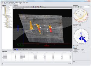
Geotechnical Analysis with Sirovision
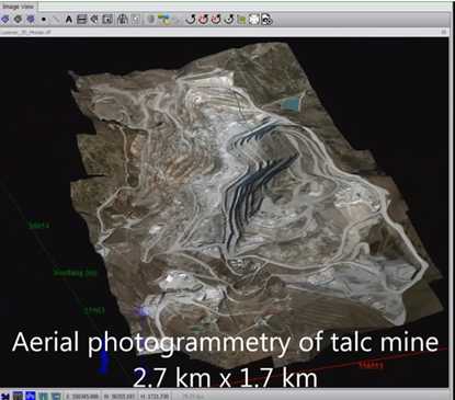
Large scale 3D model built with Sirovision
Sirovision has been commercialised by our partner Datamine Software and is used by some of the largest mining companies around the world.
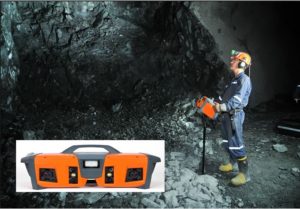
Underground Stereo Camera Rig
We developed a stereo camera rig to improve productivity in underground mining environments. Constraining the geometry of the cameras enables 3D stereo images that can be built faster, more robustly and with less survey support.
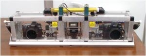
The stereo camera rig has since been commercialised by our partner Datamine Software and deployed at an increasing number of mines worldwide.