Access to Data
Research and pre-production data sets
Data is produced by CSIRO using the pre-operational system on the NCI. Users with access to the NCI filesystem (i.e. NCI registered users) can access the data there. Contact the CSIRO eReefs team for further details.
Data is progressively transferred from the NCI and made available at the CSIRO Marine Remote Sensing THREDDS server.
Data comprises mapped images of satellite surface reflectances, retrieved concentrations and various ancillary data and metrics. There is one image per satellite overpass; typically one per day, but sometimes two depending on the satellite ground track with respect to the GBR.
Datasets derived from different remote sensing satellite instruments are stored in seperate folders in the THREDDS catalog. The data can be visualised using the GODIVA viewer link that appears in the list of services for each data file, and a curated selection of recent datasets is also available to be visualised in the CSIRO eReefs Data Explorer.
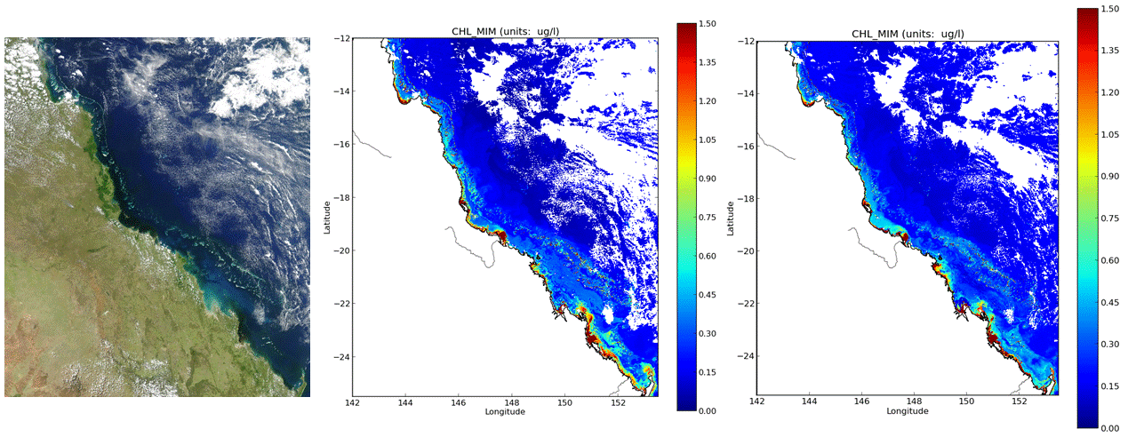
Left to right: A MODIS true-colour image of the central GBR on April 3, 2012, and the corresponding MODIS and VIIRS Chlorophyll images produced using the CSIRO regional algorithms in the pre-operational system at the NCI. The VIIRS overpass is about 5 minutes before the MODIS overpass
Note that most pre-production testing of the system has been undertaken using 2014 as an exemplar year, as it lies within the lifetimes of both the MODIS and VIIRS missions, and is not too soon after the VIIRS launch (2011) when the sensor calibration may be changing more quickly. For this reason, initially only 2014 data is available from the CSIRO system, but this will very soon extend to cover the lifetime of both missions (for MODIS, back to September 2002).
Production data sets
The marine water quality system developed by CSIRO in the first stage of eReefs (2012-2013) was operated by the Australian Bureau of Meteorology as a near-real-time production service until December 2020, with the generated datasets made available to the public via their Marine Water Quality dashboard data product.