Wildcat SLAM receives 2020 CSIRO DNFC Awards for Science Excellence
Our Wildcat team is honoured to have received the 2020 CSIRO DNFC Award for Science Excellence!
Wildcat is a new software package that uses LiDAR (light detection and ranging technology) sensor data to provide mobile robots, vehicles and enterprise customers with accurate and reliable positioning and 3D mapping information; enabling end-to-end automation of data collection and analysis across multiple industries and use cases in the most challenging environments.
At the core of Wildcat is CSIRO’s next generation Simultaneous Localisation and Mapping (SLAM) software, which leverages more than a decade of research and development in this critically important robotics research area.

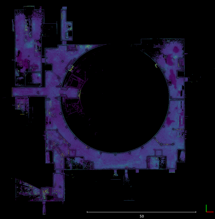
3D Pointcloud map of the Satsop nuclear power plant.
Our first-generation SLAM software (CT-SLAM) was commercialised through CSIRO’s joint-venture company GeoSLAM for handheld mapping of the built environment, while Wildcat has been developed to support applications that demand robot autonomy and high definition mapping.
Wildcat natively supports real-time distributed mapping and localisation for teams of robots or vehicles, as demonstrated by CSIRO’s Data61 team in the DARPA Subterranean Challenge.
A team of ground and aerial vehicles were deployed into a range of GPS-denied environments to navigate, explore and search for artefacts in a simulated disaster response scenario. This capability is still under active development, and we are currently seeking feedback on industry use cases that can leverage it.
Wildcat’s accuracy earned the team the “Most Accurate Detection” award, beating other teams from the world’s best robotics research labs. Wildcat has applications across multiple industry sectors and use cases including underground mining, industrial inspection, civil construction surveying, emergency response, and vehicle automation.
The technology is significantly more flexible than competing solutions as it is not limited to specific robot types or mobility platforms and works in almost any environment, from inside pressure vessels to surveying forests from the air.
Wildcat is already in use today by our EAP (Early Access Program) partners, most notably by our spinout company Emesent who have been using Wildcat for nearly two years as a key technology component of their Hovermap drone autonomy and mapping payload.
Our Early Adopter Program is fully subscribed for now, but we are always interested in discussing industry needs as we progress towards the commercial release of this technology.
For more information, contact us.
[jetpack_subscription_form title=”Subscribe to our News via Email” subscribe_text=”Enter your email address to subscribe and receive notifications of new posts by email.”]
