Our Team
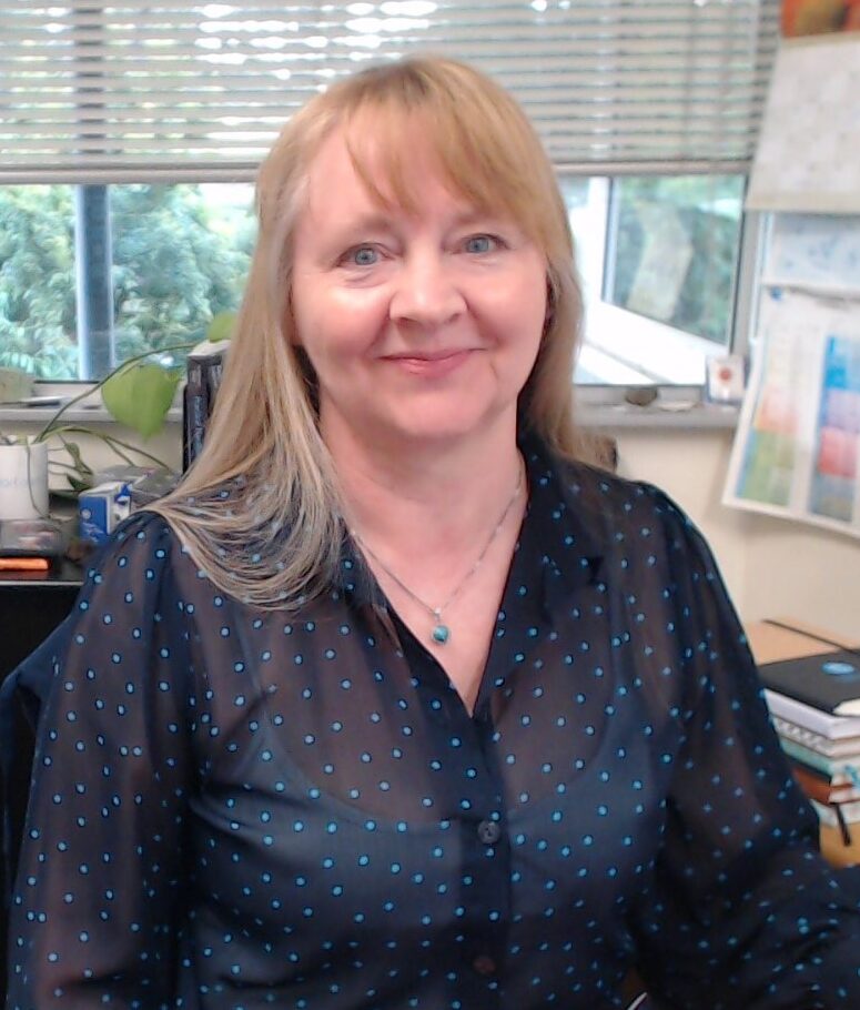
Dr Jane Hodgkinson
Principal Research Scientist
Dr Jane Hodgkinson is a Principal Research Scientist in CSIRO Mineral Resources and leads the Mining Geoscience Team. Jane is a geologist and has worked at CSIRO for 18 years on a range of environmental and geological projects, linked with mining and resources and more recently space. She is delighted to be involved with ‘in situ resource utilisation’ (ISRU) science and technology development, towards providing resources for long-term space missions and is custodian of the ISRU Facility at QCAT, Brisbane. Jane’s projects include geological spatial modelling and data analytics including self-organising maps (SOM), coal waste characterisation, geosequestration and circularity in the resources industry. Prior to her career in geology, Jane worked in the London money markets in financial, commodities and futures trading and compliance. She holds the degrees of BSc (Hons) in geology (Birkbeck College, London) and PhD in Geology and geomorphology (QUT, Brisbane). Jane co-authored The Earth as a Cradle for Life, with physicist and CSIRO Fellow, Professor Frank D. Stacey and their second book was published by CRC Press – Practical Handbook of Earth Science.
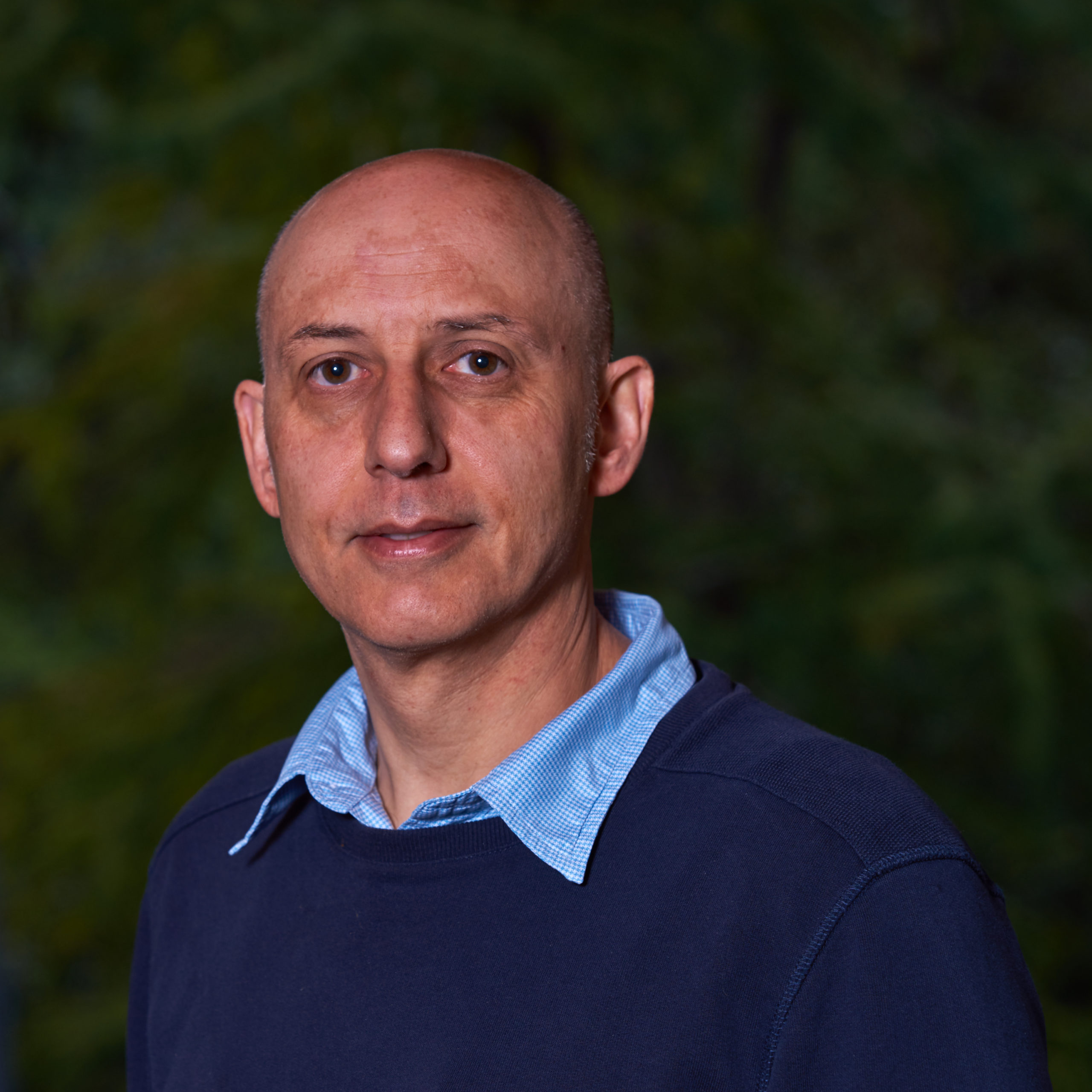
Peter Dean –
Senior Research Engineer
Peter Dean is a senior research engineer with the CSIRO Mining Geoscience Team. He graduated in Electrical and Electronic Engineering from the University of Wales in 1987. His career began in the aerospace and defence sector developing safety critical software for Rolls Royce engines, Type42 Destroyer and as a lead engineer for the Boeing 777 fuel management system and BAe Tornado health monitoring system projects. He spent the next six years developing high integrity software for very large process control systems in the air traffic management and energy sectors. Since 2001, Peter has worked for CSIRO providing remote sensing and 3D imaging technologies to the mining and aerospace sectors. This has included software development for the Sirovision geotechnical analysis package now commercialised by CAE Datamine. He developed the CoreProfiler software product that enables consistent drillcore logging from a scaled core digital image. His other notable highlights have included the coal stockpile mapping project and integration of thermal imaging systems onto mining shovels to detect hot spots and has worked with Boeing on some high profile projects to deliver computer vision technologies. Peter worked with the multi-disciplinary team to deliver the Multi Resolution Scanner that is now on the ISS.
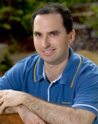
Michael Lofgren – Senior Research Engineer
Michael Lofgren has been working as a Research Software Engineer at CSIRO for over 25 years. Now based in the Mining Geoscience team, he has combined his computing and physics knowledge to develop software for instrumentation control and data analysis in a long list of research areas, including nuclear spectrometric borehole logging, self-organising maps, airborne gravity gradiometry, tele-operated shiploading, banana screen vibration monitoring, microseismic monitoring and distributed acoustic sensing. More recently Michael has been working on applying 3D Imaging to projects involving Boeing and NASA.
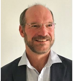
Wayne Stasinowsky –
Senior Research Scientist
Wayne Stasinowsky is a geophysicist experienced in most geophysical techniques. He has conducted R&D and field surveys in radar, 2D and 3D seismic, TMI and tensor magnetics, ground and airborne gravity and gradiometry, 2D and 3D induced polarisation and magnetotellurics. He has developed new field procedures and processing algorithms for all of these techniques. Wayne also has extensive experience with applying geophysics to operating open cut and underground mines to assist mine planning and to gain geotechnical information. Wayne has also worked in IT as a developer, project manager and knowledge management specialist.
Dr Romana Dew –
Senior Research Scientist
Romana Dew started with CSIRO at the Queensland Centre for Advanced Technologies as a Senior Spatial Scientist in March 2024. She is an experienced geoscientist with 18 years of multidisciplinary GIS experience with qualifications in both geology and geography. Romana has published nine scientific publications, primarily focussed on the geochemistry and tectonic evolution of Thailand and Australia, but also coastal geomorphology and diversity in geosciences. She has worked in the field, laboratory and in the office for mining and petroleum companies, academia, government and environmental consulting. Romana has operated across the mining value chain in interdisciplinary projects from geotechnical engineering, structural and resource geology, geospatial visualisation, remote sensing, hydrogeology, ecology, environmental approvals, management and policy. She actively promotes inclusivity and is engaged with Women in Earth and Environmental Sciences in Australasia (WOMEESA) and STEM Professionals in Schools.
George O’Connor – Software Engineer
George O’Connor is a Software Engineer at CSIRO specialising in Computer Vision technology. He graduated with a master’s degree in Mechanical Engineering from the University of Melbourne in 2017. George began his career building UAVs and developing an Unmanned Traffic Management platform in Telstra Labs. He then spent 4-years as a freelance robotics engineer on a wide range of projects and technologies covering electrical and mechanical prototyping, computer vision, AI, web development, IoT, control algorithms and software engineering. Most notably, this included developing the hardware and software for a tennis ball collecting robot, developing a Kalman filter based position prediction algorithm along with a simulation environment for a ship cleaning robot. He has worked on embedded firmware for low-cost autonomous environmental methane sensors, along with a IoT web platform for control and telemetry. George is working on a high-precision stereo-imaging slope-monitoring system. His key focus is to develop large, integrated software systems that increase mining safety and efficiency.