RECOM output at Marine Monitoring Sites
The animations below show the application of CSIRO’s Relocatable Ocean Model (RECOM) at the Marine Monitoring Program sites. The purpose of these animations is to:
- Investigate the processes occurring in the vicinity of the sites. In particular, are the water properties dependent on the larger scale processes shown by currents moving across the whole region, or are they dependent on local processes like island wakes?
- If local processes dominate, does the higher resolution model improve the fit between the observed and modelled variables.
A description of the animations is given at the bottom of the page.
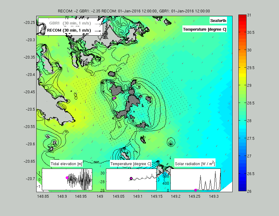
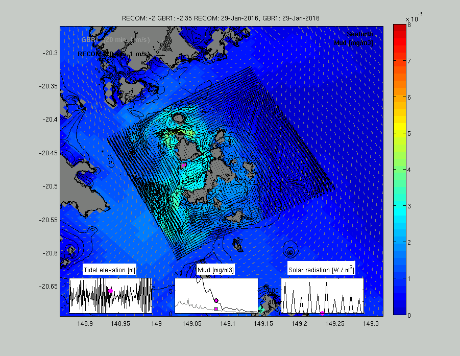
Seaforth
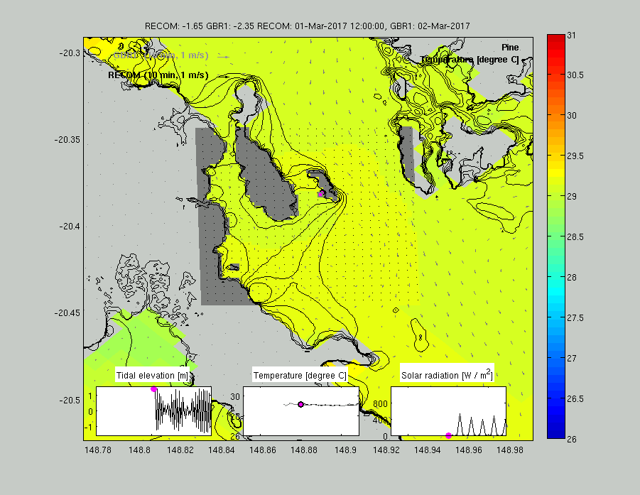
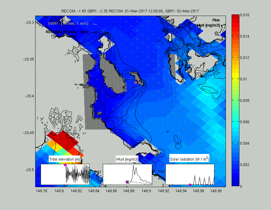
Pine Island
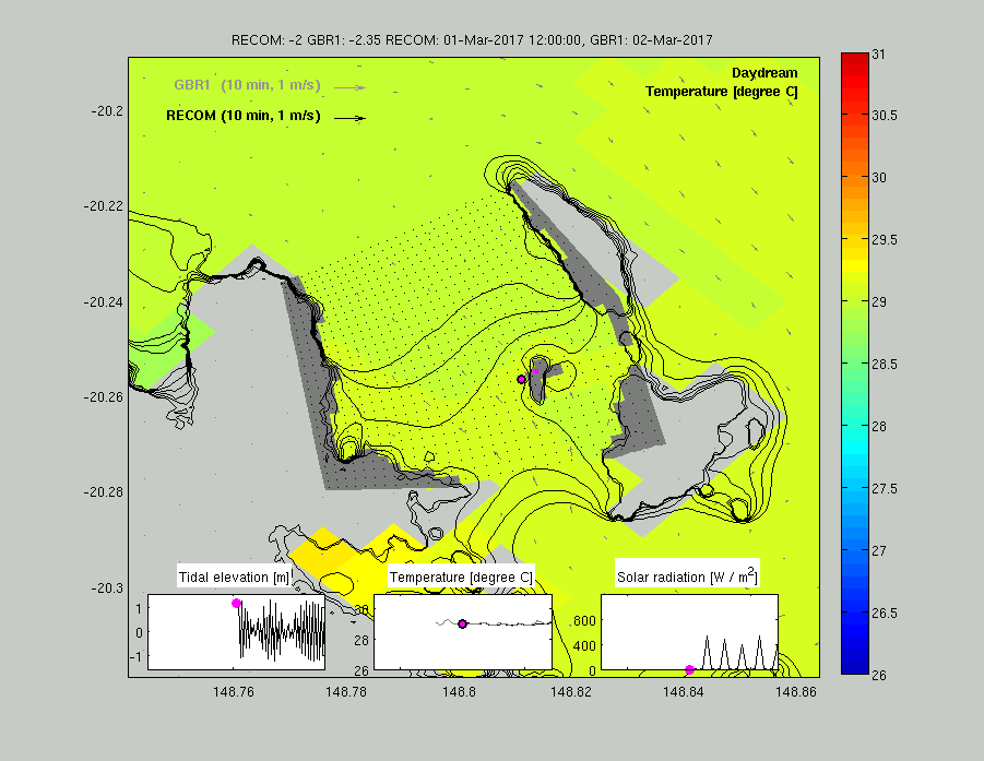
Daydream Island
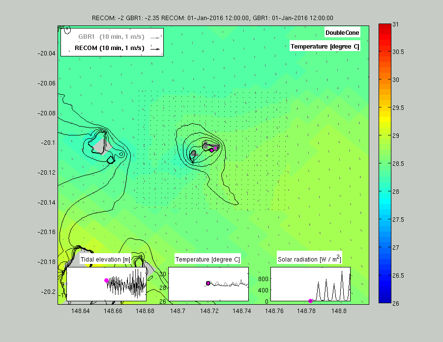
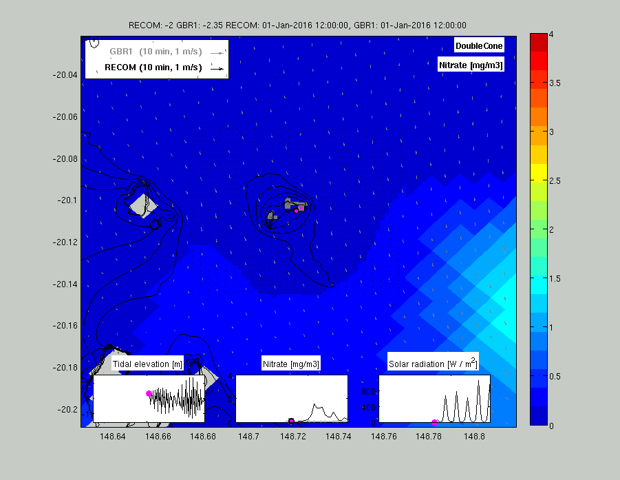
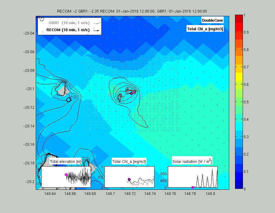
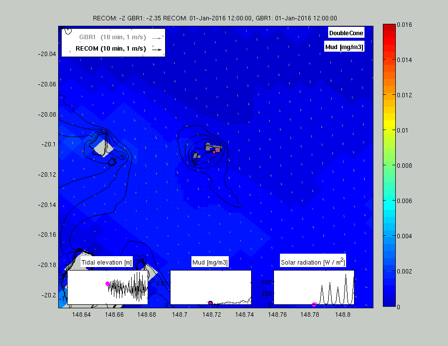
Double Cone Island
Fitzroy Island (near Cairns)
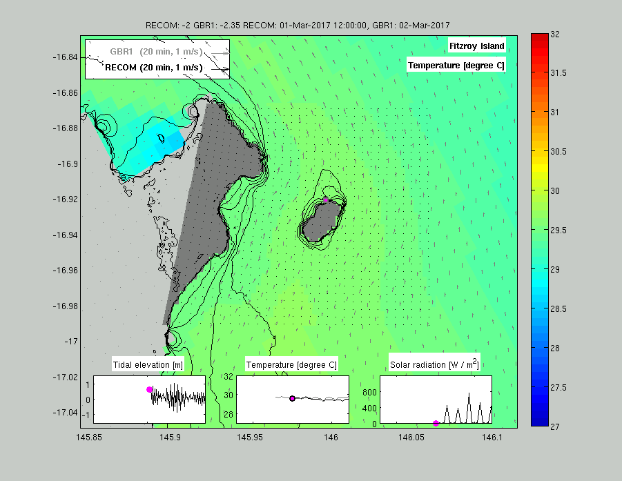
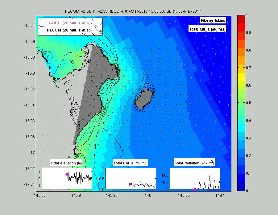
Description of the animations. The animations shows two model outputs. The higher resolution (~200 m) RECOM outputs are shown in the centre of the animation (with black current vectors), while the GBR1 output that RECOM is nested into is shown in the surrounding waters (with grey vectors). The 100 m resolution GBR100v4 bathymetry is shown as thin black lines. Land defined by RECOM is shaded dark grey, while land defined by GBR1 is light grey.
The colouring shows a model variable (temperature, suspended sediment concentration, chlorophyll concentration etc.) in the near surface waters in both the high resolution grid (centre of image) and in the 1 km resolution regional model. The GBR1 model also produces output in region occupied by the RECOM grid, but this is not shown for the surface.
The inserts shows for the locations of the pink dots, a time-series of the tidal elevation, solar radiation and the model variable. The insert for the model variable shows the value of GBR1 (grey) and RECOM (black). The time stamp, and layer depth of the two models, is given in the title. The scale for the current vectors defines a velocity, and is scaled to show the distance a particle would travel in the given time.