Whitsundays region
This page contains animations to support the “Scoping study to address poor water quality in the Whitsunday Region: interim report”
Comparison of observed MMP sites and 1 km eReefs model.
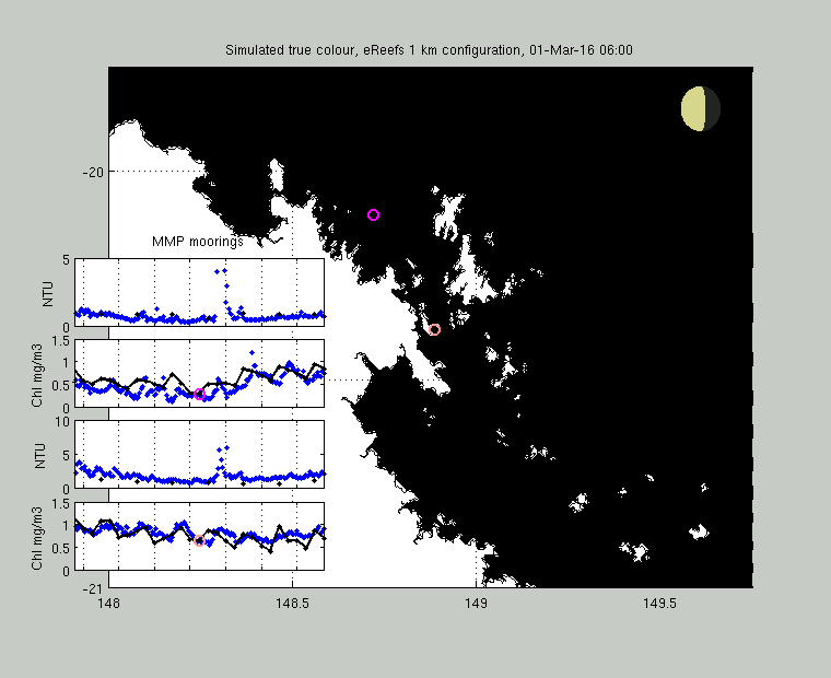
Fig. 1. The image shows simulated true colour every hour calculated from the model-calculated normalised water-leaving irradiance. Yellow is river or resuspended sediment, dark green is CDOM and green-blue is phytoplankton. The moon phase is shown in the top left – look for the greater impact of new and full moons on tides and therefore resuspension. True colour can only be calculated with the zenith above the horizon, so each ~12 hour night period is represented by darkness.
Cyclone Debbie
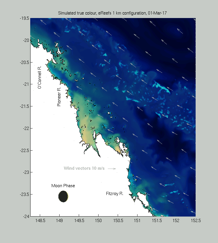
Fig. 2. Movie composed of midday snapshots of the Whitsundays region for the month proceeding during Cyclone Debbie, and just afterwards. Arrows are surface winds. Look for resuspension followed by discharge from the Fitzroy and Pioneer Rivers.