We are going to Space! Space Technology FSP
We are going to Space! Space Technology Future Science Platform (FSP)
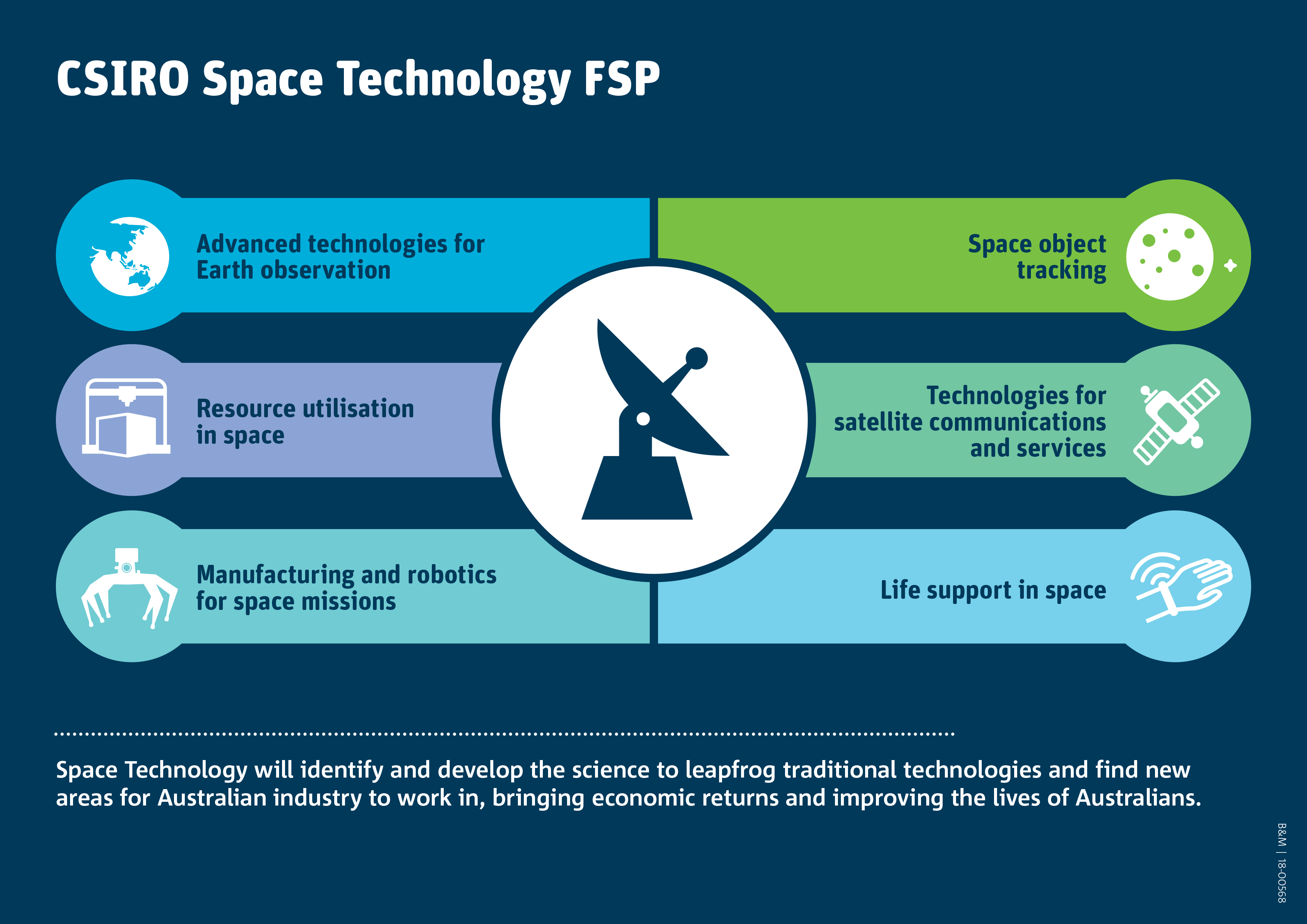
The Space Technology FSP aims to build world-leading capability and deliver cutting-edge research within CSIRO to support the Australian Space Agency’s goal of tripling the size of the Australian space industry by 2030.
Space Technology FSP received $16M to identify and develop the science to leapfrog traditional technologies and find new areas for Australian industry to work in.
CSIRO’s Data61 Robotics and Autonomous Systems Group have joined forces with CSIRO Agriculture and Food Business unit and Digiscape FSP to develop integrated tools for Australian space industry by bridging the scale gap between satellite observations and localised autonomous ground robot- and drone-based measurements to estimate different attributes of agricultural crops.
Satellite imagery with high temporal resolution is best for dynamic crop monitoring. The more acres and growers an agronomist manages, the more important it becomes to identify which fields need attention quickly.
The conventional method of informing satellite imagery using field measurements is challenging giving the resources needed for manually collecting a representative sample.
To alleviate this, we aim to bridge the scale gap between low-resolution global satellite data and detailed but localised autonomous on-ground assessment of agriculture by developing the science to enable the use of spectral and structural 3D data captured by autonomous technologies such as UAVs and ground robots.
“We have developed a range of technologies that are relevant to the Australian space industry, including autonomous mapping of farms using 3D LiDAR and hyperspectral/multispectral imaging technologies, and advanced machine learning and statistical analysis”, said Dr Peyman Moghadam, AgTech Cluster Leader for the Robotics and Autonomous Systems Group.
According to Dr Moghadam, “what we are trying to do in this project is to combine UAV/UGV based measurements with satellite imagery through the latest machine learning algorithms”.
For more information, contact Dr Peyman Moghadam.
[jetpack_subscription_form title=”Subscribe to our News via Email” subscribe_text=”Enter your email address to subscribe and receive notifications of new posts by email.”]