Hydrodynamics – GBR1
Below we show reef temperature exposure plots using GBR1 and of specific section throughout the GBR.
We also depict specific regions along the GBR coast: Palm Passage (top box in figure) and Capricornia (lower box in figure), as well as various time series transects.
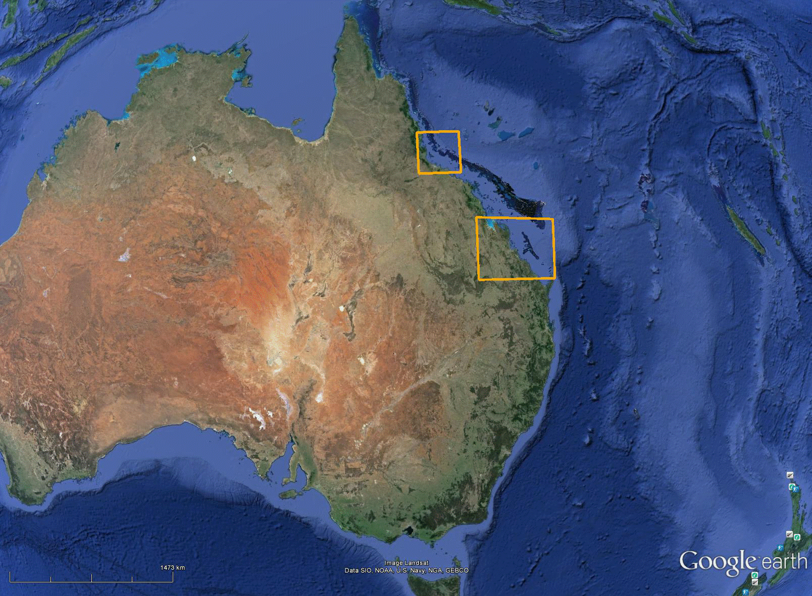
Geographical placement of the Palm passage (top) and Capricornia (bottom) stills and animations shown below
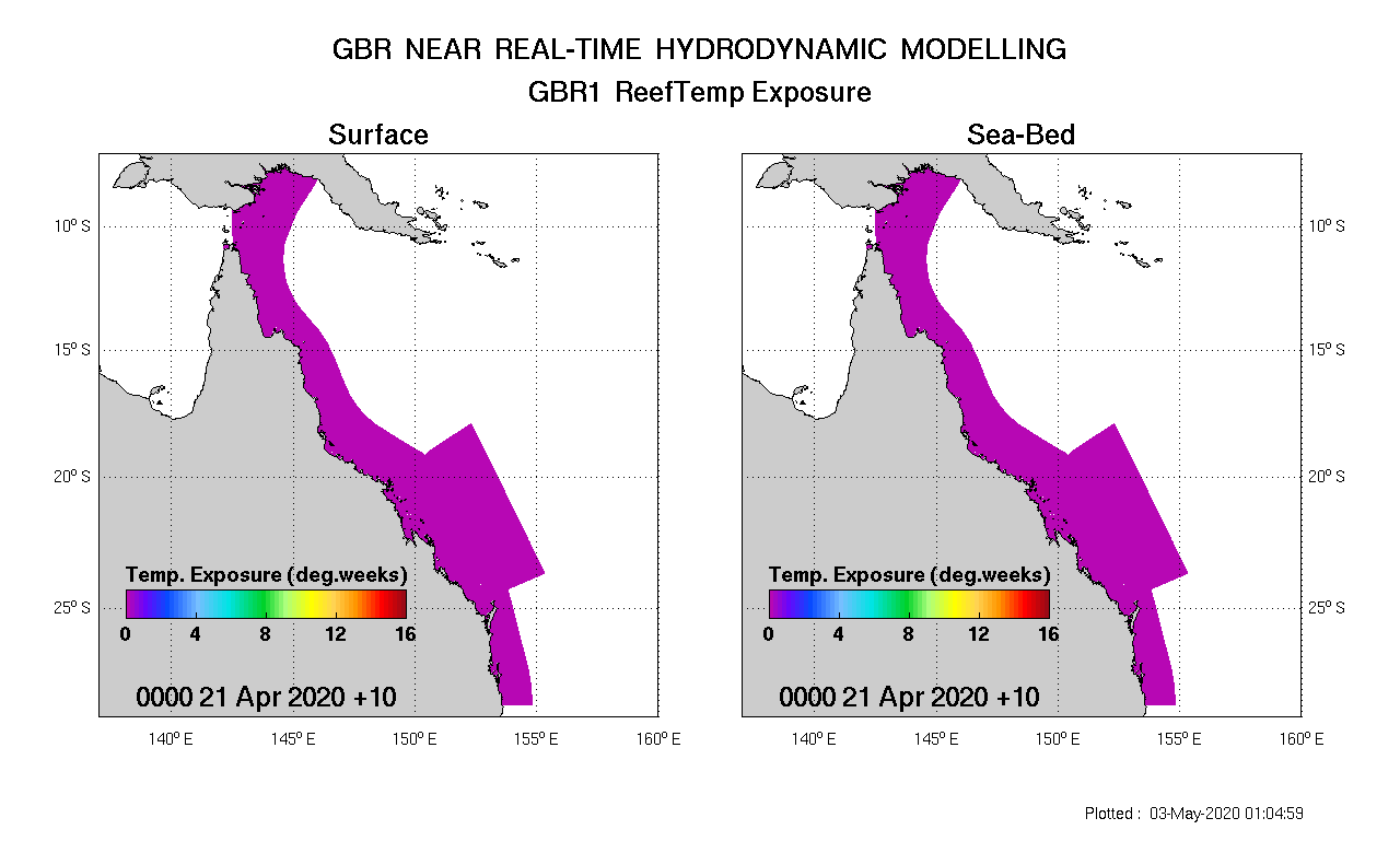
GBR1 reef temperature exposure: near real time animation
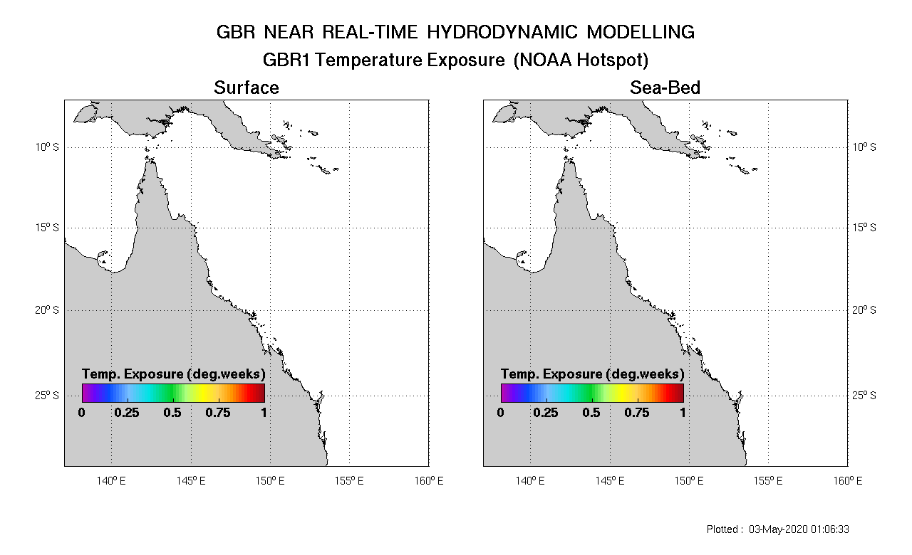
GBR1 Temperature exposure NOAA hotspot map: near real time animation
Palm Passage
Palm Passage currents, temperature and salinity snapshots and animations are accessed via the links below. Click on the animation to view the animation in a new page. The ‘still’ link provides the most recent snapshot of the archive, whereas the animation provides several days of the most recent output appended to the archive.
Output from GBR4 is provided as well as GBR1 for reference. There is considerably more fine-scale structure in GBR1 due to its higher resolution. This is particularly evident when viewed in relation to the bathymetry.
Palm Passage Currents and bathymetry.
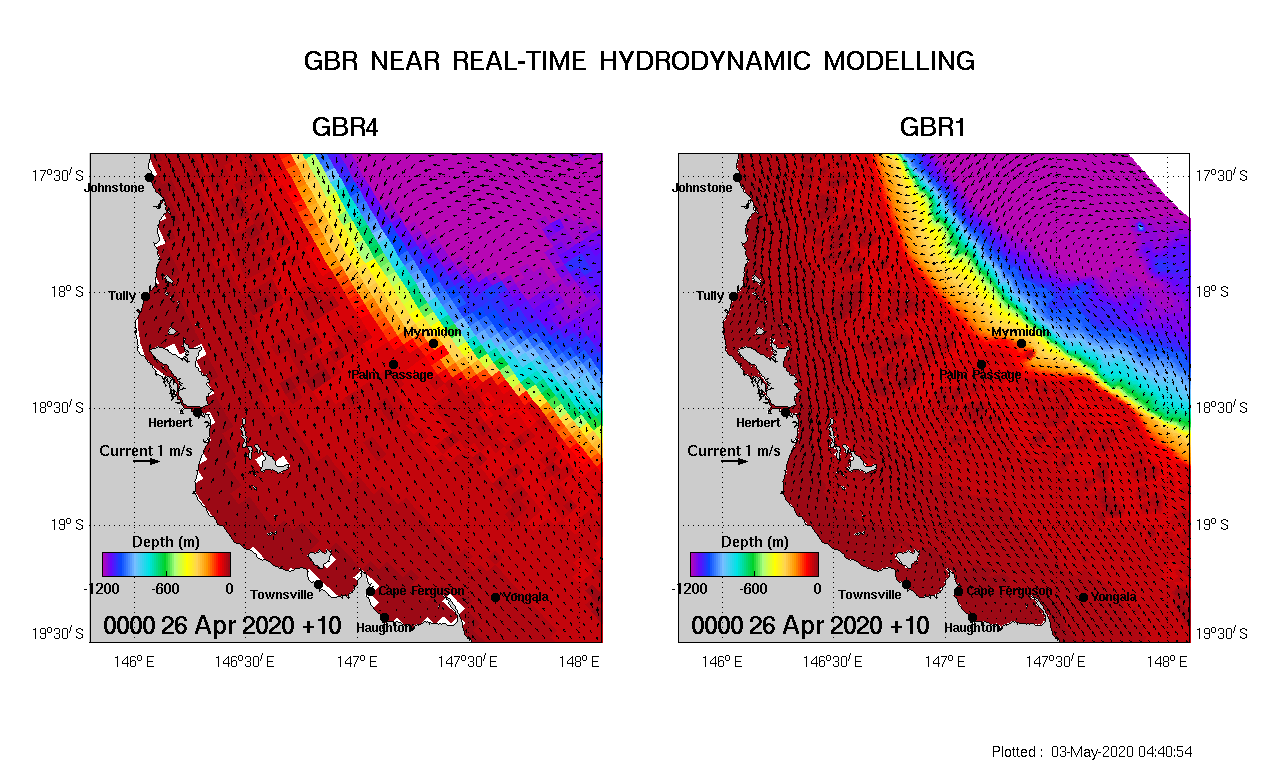
Link to Palm Passage currents – still
Palm passage currents and sea surface temperature.

Link to Palm Passage surface temperature – still
Palm Passage currents and sea surface salinity.
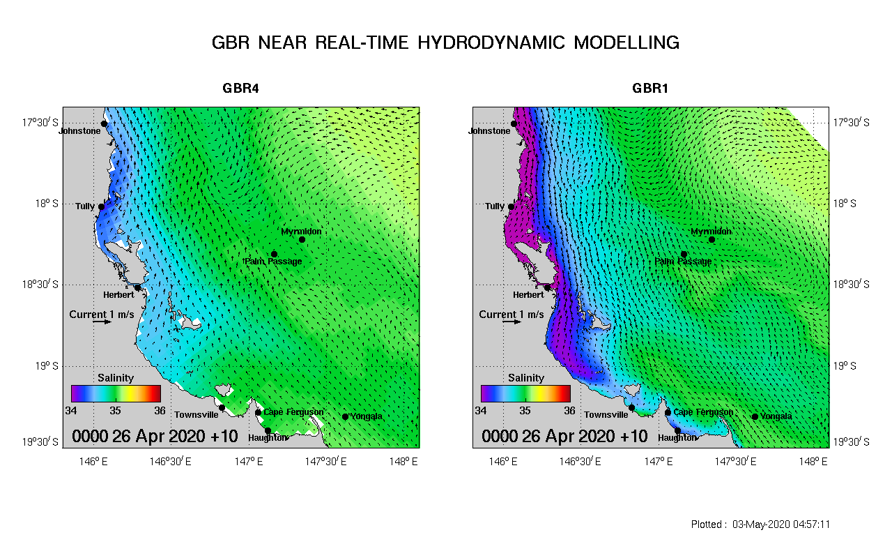
Link to Palm Passage salinity – still
Capricornia
Capricornia currents, temperature and salinity snapshots and animations are accessed via the links below.
Sea level and tides – still / animation
Surface temperature and currents – still / animation
Surface salinity and currents – still / animation