Shovel Loading Automation
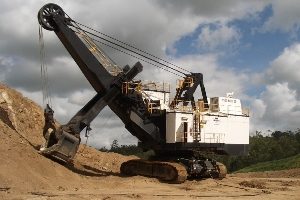
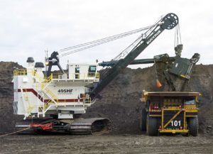
With funding from the Australian coal industry’s research program ACARP, CSIRO is collaborating with the Cooperative Research Centre for Mining, to develop automated swing loading technology for electric mining shovels. Our contribution to this project is the development of a system which takes input from a variety of sensors (including lasers and mm-wave radar) and uses this to construct and maintain an accurate model of the shovel’s environment capturing the shape and form of the face, the position and location of the crusher-conveyor or truck and the shovel itself.

Electric ropes
- 2004 ACARP Tech Report C12030 – Rope Shovel Automation
- 2006 ACARP Tech Report C13041 – Swing Loader Traffic Control
- 2006 ACARP Tech Report C14058 – Shovel Automation – Phase 2
A second project demonstrated (on a 1/7th scale model swing loader and haul truck) the technology to manage traffic around a swing loader and direct drivers to recommended loading position (spotting). Traffic Management around shovels and excavators in the mining environment is still an unsolved problem. A proposed solution to the problem of vehicle tracking is a compromise between absolute (global) and relative (local) coordinate systems. This is achieved by dividing the space around the shovel into three zones: the outer zone, where the trucks are ignored by the shovel; the handover zone, where the shovel starts to direct the truck’s movement; the work zone, where the truck is within range of the shovel sensors.

Mining Machinery
The technology to direct drivers to a recommended loading position (spotting) occurs in two phases. In the first phase, a scanning range laser on the swing loader is used to generate a digital terrain map of the surrounding area. This is used to define the navigable space around the loader and the loading position closest to the bench (spotting). In the second phase, another scanning range laser is used to continually estimate the pose of the truck with respect to the swing loader. A path is then generated between the current pose and the desired loading position. The steering and speed response required to follow this path is displayed to the driver. If the driver chooses (or is unable) to follow the desired path, the system adapts and recalculates a new path.
The trials conducted at QCAT demonstrate that the guidance technology is able to assist a driver to more accurately position the truck to the recommended loading position. With a reduction in visibility normally experienced by truck drivers in the mining environment, the path planning software has the potential to also exceed the performance of the unassisted human operator. Furthermore, the enhanced situational awareness provided by the technology can prevent collisions between vehicles and local infrastructure
Patents
- US20120191431A1 Autonomous loading
- US20100223008A1 Method for planning and executing obstacle-free paths for rotating excavation machinery
Videos
