Using satellite data to unlock water quality knowledge
Originally published in ECOS 27 Apr 2022. By Jane Nicholls.
Data cubes built using decades of satellite images reveal how the quality of estuarine and coastal waters changes after weather events, and over time.
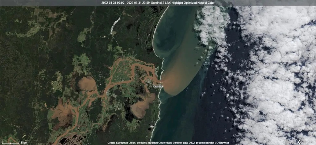
This satellite image of the mouth of the Clarence River at Yamba shows a large sediment plume. The plume extended some 30km into the Tasman Sea. Image: European Union. Modified data from Copernicus Sentinel-2, processed with the Sentinel Hub EO Browser.
This satellite image of the mouth of the Clarence River at Yamba shows a large sediment plume. The plume extended some 30km into the Tasman Sea. Image: European Union. Modified data from Copernicus Sentinel-2, processed with the Sentinel Hub EO Browser.
At CSIRO’s Black Mountain campus in Canberra, three passionate CSIRO scientists have turned decades of satellite data into powerful knowledge. Their work includes assembling a rich data cube and analysing the remote sensing data within it to understand how water quality has changed over the past 20 years.
A project with the NSW Department of Planning and Environment (DPE) is filling in vast knowledge gaps about our waterways. This will help inform better decisions and mitigation strategies to preserve water quality and biodiversity.