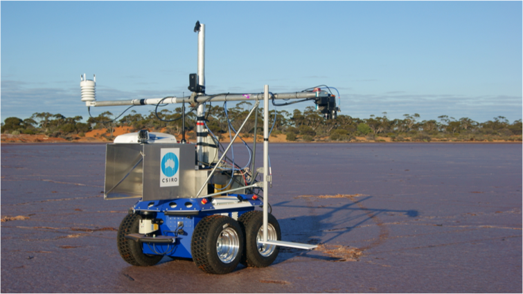
Autonomous Science Rover
|The challenge
Satellites need to be regularly calibrated
Earth observation satellites need to be regularly calibrated to ensure the accuracy of their observations. This is done using a process called vicarious calibration, which involves ground crews walking in grids or transects and taking measurements with hand held devices called spectrometers.
This happens at the same time the satellite is travelling overhead, and the two sets of data are compared to ensure the accuracy of the satellite.
This often needs to be done at remote locations such as Lake Lefroy, a salt lake in Western Australia, due to its bright and uniform surface. Unfortunately it’s a long way from any urban centres, making it a time consuming and difficult proposition to conduct regular calibrations.
|Our response
Automating the calibration process

Autonomous Science Rover
Autonomous Science Rover
We developed an autonomous vehicle, the Outback Rover, to help scientists automate and remotely manage this process.
While it’s currently in prototype stage, the ultimate goal is to have the rover operate alone, with scientists from all over the world able to retrieve data from it and control it remotely in real-time.
As well as ensuring the accuracy of the current suite of space travelling cameras and sensors, the information collected by the rover could also be used for the next-generation of satellites that will use high-resolution hyperspectral images.
These satellites will be able to collect more detailed data, including information about dry and woody plant materials and specific mineralogical data that cannot be measured with current operational satellites.
|The results
Making the process simple
By automating and being able to remotely manage the satellite calibration process, scientists across the world will be able to spend more time focusing on the important data collected by the satellites, such as where to explore for mineral deposits and the current state of a particular patch of soil.
