Unlocking mineral resources using satellite data
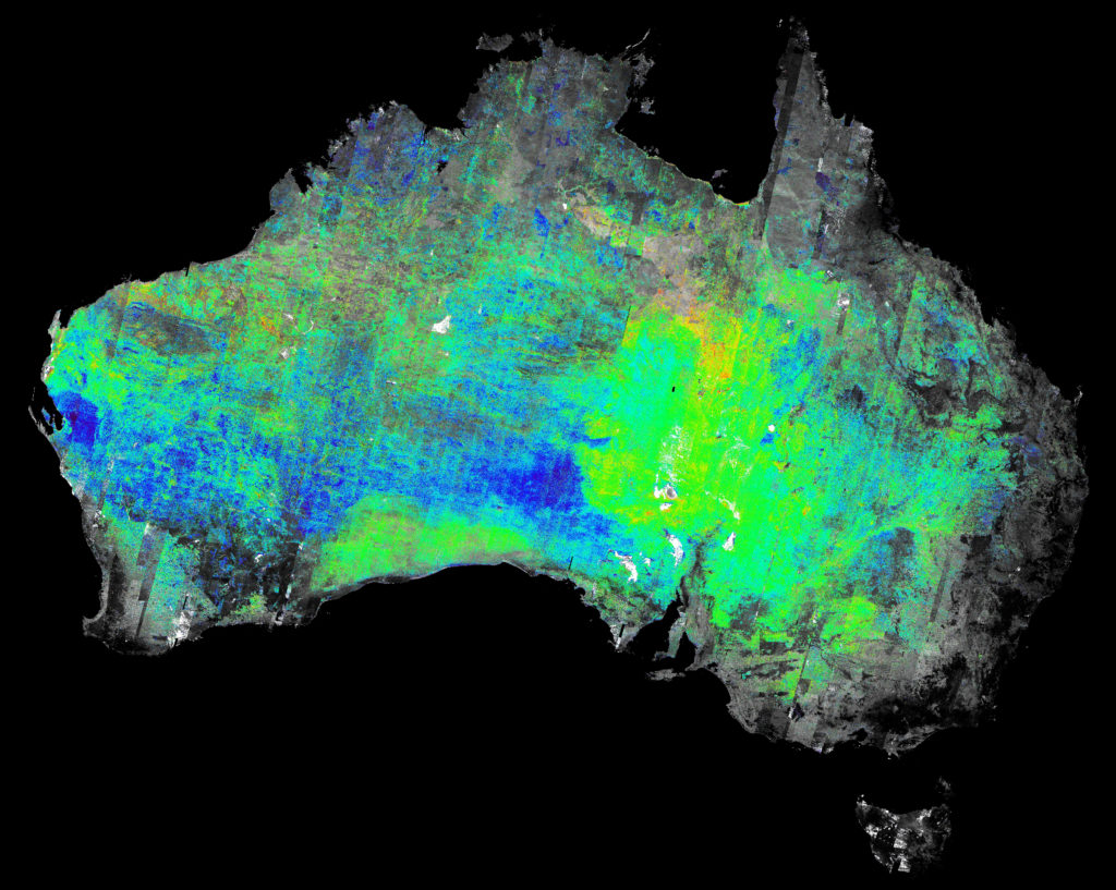
The world-first suite of mineral maps details the mineral composition of the surface of the continent.
The world-first suite of mineral maps details the mineral composition of the surface of the continent.
We developed the first continental-scale minerals maps for exploration and investment opportunities in Australia.
Who are these for?
- Any users interested in minerals
- mineral explorers (big and small companies)
- state geological surveys
- government departments, particularly associated with mining and agriculture
- consultants and natural resource managers.
Australia supplies many of the world’s commodities including rare earth elements, such as lithium, that are used extensively in modern technology. These minerals have only in recent years been the focus of mining and exploration companies.
Challenges
- Lack of consistency between maps for different areas and imagery because of uncorrected instrumental, atmospheric, and landscape change issues.
- This inconsistency hampers interpretation of the data, for example, being unable to map minerals and/or define boundaries. Essentially, before CSIRO started this project there were many consultants who produced various maps but there were challenges in either the interpretation of the results or they were not able to put the maps together consistently as every map was produced using different methods of processing the data as well as not correcting for instrumental, atmospheric issues.
- Australia supplies many of the worlds ‘critical’ (both economically important and high risk of supply disruption) commodities. Some of these commodities are important for technology advancement and carbon emission reduction. For example, Australia has large resources of rare earth elements, such as lithium, which is used extensively in modern technology. These minerals have only in recent years been the focus of mining and exploration companies.
- Big industry, important for the economy: In 2015–16, mining directly contributed around 6% of Australia’s GDP, employed more than 220,000 people and generated 50% of the nation’s export earnings. The indirect contribution for the same period is estimated to have added a further $103.6 billion to the economy and over 650,000 jobs directly related to exploration, mining and the Mining Equipment Technology Services (METS) sector.
- The mining industry in Australia is calling for significant investment to uncover new potential mining prospects and are focused on reducing operating costs by improving efficiency.
What we did
- Secured access to a comprehensive dataset of ~35,000 ASTER satellite sensor scenes from 10 years of archival data over Australia, noting that at the time the access was limited and ingesting all these scenes into an accessible archive. (The Advanced Space borne Thermal Emission and Reflection Radiometer [ASTER] is a Japanese imaging instrument on NASA’s Terra satellite.)
- Selected the most appropriate 3,500 used in the final mosaic.
- Developed the methods and software tools to process satellite imagery to remove the instrumental, atmospheric effects and seasonal features to correct the base products.
- Ground truthed and sampled to validate the final products.
- Developed the delivery mechanism together with AuScope, Geoscience Australia and state geological surveys so that the data products can be accessible to everyone.
Outcomes
The ASTER mineral maps are already changing the way that geoscientists look for mineral deposits by providing more accurate and detailed information than ever before.
In the first three months following their release in 2012, the maps were downloaded 40,000 times, and have become the default base map for mineral exploration in Australia.
The ASTER mineral map was the first Australian continental scale mineral-group map produced using Earth observation. In a recent assessment by ACIL Allen Consulting (2015) the ASTER map was described as “a default base map for exploration”.
This map contributed to the discovery of a Copper Gold prospects/deposits in the Jervois area (Eastern Arunta Inlier, NT), announced by Kentor Resources. The work also won the Australian Mining Journal Award “Explorer of the Year” in 2012.
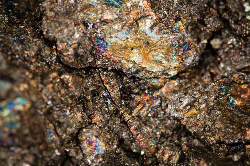
Minerals Chalcopyrite, Pentlandite, Pyrrhotite. Photo by USGS on Unsplash.
Minerals Chalcopyrite, Pentlandite, Pyrrhotite. Photo by USGS on Unsplash.
National and international impact
The ASTER map provides important information that explorers never had previously, which has led to new discoveries of minerals and improve targeting. The impact from ASTER map would likely be in the order of millions of dollars’ worth of saved time during exploration missions. Internationally, the impact has been significant as ASTER mineral map was the first continental mineral map and inspired other nations to use these data sources.
Satellite technology for mineral exploration is aligned to the Uncover Australia initiative which aims to focus Australia’s geoscience effort on providing the knowledge base and technology that will substantially increase the success rate of mineral exploration. It also underpins regional Earth Observation products used for exploration and obtaining a better picture prior to focused investigation.
CSIRO has been collaborating with Japanese space agencies, Japan Space Systems and AIST and, NASA for over twenty years in order to capture the opportunity of continental-scale mapping of land surface mineralogy over Australia.
Why CSIRO?
CSIRO has built over four decades of unique expertise in applications of EO data for the mineral industry particularly for mineral mapping and building the technology for collecting the measurements and know-how and infrastructure for calibrating sensors and validate the data products. This breadth and depth of knowledge is highly valued by our national and international partners.
Partners
Geological Surveys of Western Australia, South Australia, Northern Territory and Queensland; Western Australia State Government; Geoscience Australia; Japan Space Systems; AIST – Geological Survey of Japan; NASA.
The ASTER Geoscience Maps of Australia were made possible by funding through the WA Exploration Incentive Scheme and WA Centres of Excellence funding (for establishing C3DMM), as well as support by the Australian Federal, State and Territory Geological Surveys.