Rural Intelligence Platform

The Rural Intelligence Platform delivers reliable farm data and analytics.
The Rural Intelligence Platform delivers reliable farm data and analytics.
We’re working with rural technology startup Digital Agriculture Services to create an innovative new platform that delivers reliable, independent and robust farm data and analytics.
The Rural Intelligence Platform is the first ever software to comprehensively assess and monitor rural land anywhere in Australia. It draws on information from trusted data sources on productivity, water access, yield, land use, crop type, rainfall, drought impact and more.
Who is it designed for?
Farmers and the global agriculture industry including: business, policy makers, finance, insurance, agribusiness, property and farm services industries.
The platform is relevant to any stakeholder that plays a role in the prosperity and sustainability of agriculture.
Challenges
- Businesses, policy makers and farmers are making decisions without reliable rural data or analytics. It is estimated that $128 billion in economic decisions in Australia annually are based on unreliable or incomplete data, despite the importance of food and agriculture to our economy. This “data desert” extends beyond Australia to many other countries.
- While mapping and monitoring the agricultural land system sounds simple, it is much more challenging than digitising city or urban landscapes.
- Existing rural data is notoriously patchy and fragmented; inaccessible or unintelligible; and simply not connected in a way that’s useful.
- There is no single reference system or digital model of all rural land in Australia that’s searchable and up-to-date that can be used to answer specific questions at farm-level; nor solve problems up and down the agricultural value chain.
- Capital investment (estimated at $2 trillion) needed to feed 10 billion people more efficiently is not being released due to uncertainties and risks.
What we did
- Assembled a multi-disciplinary team in the context of clear commercial and customer requirements from DAS from three business units within CSIRO (Food & Agriculture, Data 61 and Land & Water). It includes earth observation, data analytics, machine learning, AI and GIS capability as well as deep domain and digital expertise.
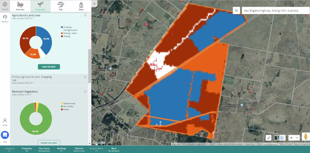
- Integrated earth observation (satellite data includes imagery from Landsat, MODIS, Sentinel-1 and Sentinel-2) with modelling (eg. biophysical, plant physiology), machine learning and Artificial Intelligence technology.
- Build system that updates every 2–3 weeks to combine data with domain knowledge, tapping into historical records.

Screenshot from the Digital Agriculture Services system
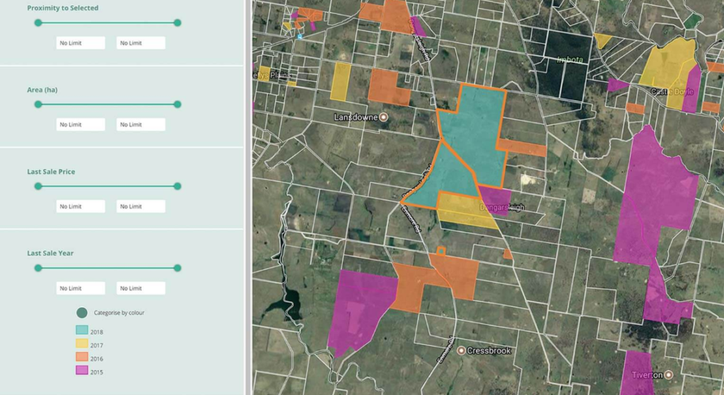
Screenshot from the Digital Agriculture Services system
Outcomes
The creation of the industry-first Rural Intelligence Platform, which provides:
- A completely new way to see and understand 371 million hectares of Australian land, as part of an ever-evolving map and living engine that is improving all the time, as new features are added.
- Independent, evidence-based and science-supported rural, agri and climate analytics of a quality never seen before in the marketplace.
- A suite of emerging rural data and software solutions that leverage the DAS Rural Intelligence Platform™ and solve critical business problems including the DAS Rural Property Hub, the DAS Rural Valuations Hub and the DAS Commodity Hub.
National and international impact
Fundamental to the DAS mission and vision is reducing risk. By reducing risk, this solution brings profound and positive change to the ecosystem that surrounds the farmer. The technology is designed to solve multiple problems up and down the agri-value chain including:
- Meeting global demand for farm-scale or farm-level insight, including crop identification and yield prediction in a model that that can be scaled across key commodities including wheat, barley and canola, as well as large geographic areas across the globe.
- Ensuring farmers have greater access to independent insights backed by science. DAS provides Australian farmers with unlimited access to the Rural Intelligence Platform plus the ability to download “one touch” property reports on their farms.
Why CSIRO?
This is a unique partnership and collaboration based on very different thinking for a very different future.
- It is multidisciplinary; combining market and customer knowledge and commercial experience with CSIRO’s expertise and more than 100 years’ experience at farm level.
- Driving innovation: taking research and development and driving impact through a strategic, commercial partnership.
- It is a truly unique relationship; this is a venture science partnership unlike any other. It brings together a startup with 17+ team members supported by 20+ leading ag and data scientists including a dedicated team focused on climate risk in agriculture.
Partners/data sources
- PSMA Australia
- state/territoriy and federal Government data
- Bureau of Meteorology
- Open Data Cube
- CSIRO big data infrastructure such as Senaps-Land software, APSIM.

