Soil and Landscape Grid of Australia
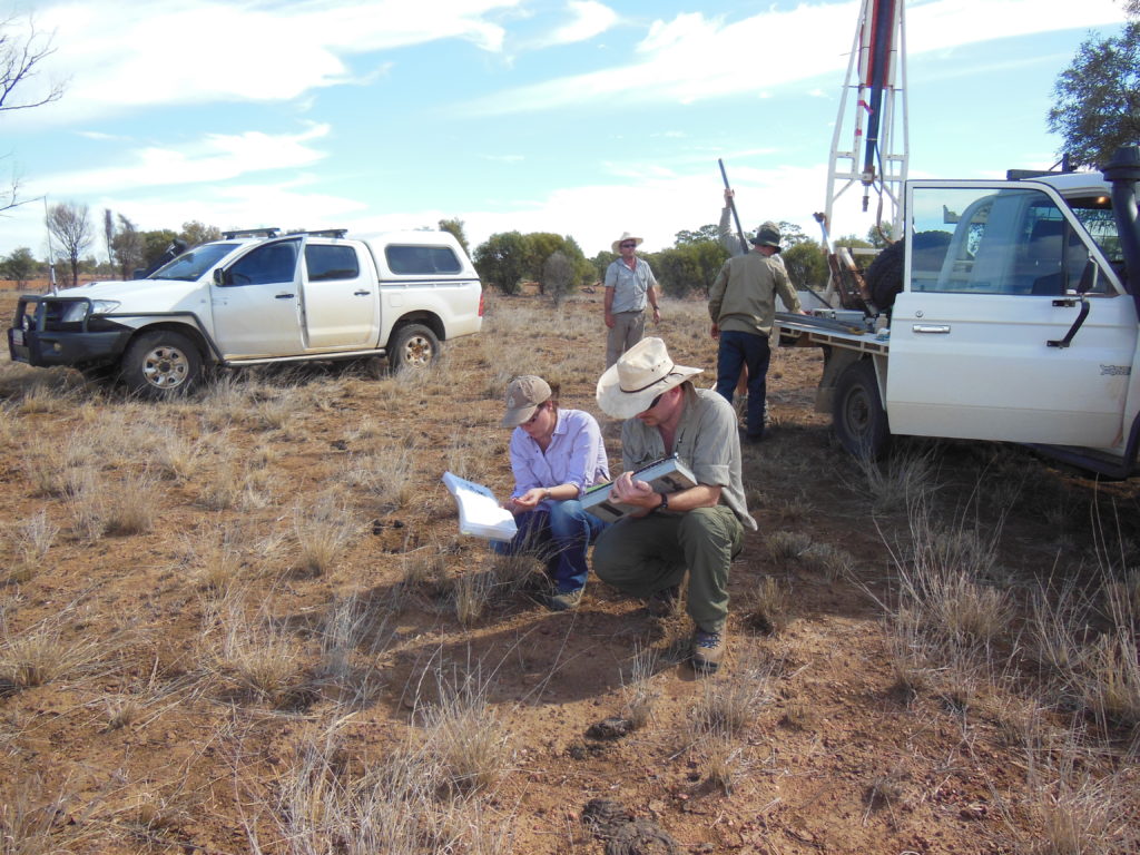
Soil sampling provides important data for the Soil and Landscape Grid of Australia. ©Image: Rebecca Bartley, CSIRO
Soil sampling provides important data for the Soil and Landscape Grid of Australia. ©Image: Rebecca Bartley, CSIRO
Together with our partners, we’ve developed detailed digital maps of the country’s soils in an easily-accessible format. The Soil and Landscape Grid of Australia is the first fine-scale, comprehensive soil function grid for the entire continent. Earth observation is a crucial part of it.
Who is this designed to help?
- Government agencies
- agriculture industry advisors
- software developers
- infrastructure and engineering consultancy firms
- environmental consultants
- environmental and agricultural researchers
- educational institutions and private individuals.
Challenges
Soil features such as water, nutrient and clay content affect the sustainability of Australia’s natural resources and the profitability of sectors such as agriculture, mining and infrastructure.
In the past, information about Australia’s diverse soils and landscapes was held in many places and there was no consistency among datasets. Users had to process data themselves, often taking thousands of hours a year. As a result, soil information was rarely included in agricultural models, infrastructure planning or ecological assessments. Examples of these include APSIM and environmental systems including biodiversity assessment, climate impact modelling, regolith mapping, erosion and sediment movement and environmental accounting.
What we did
- Changed the nature of soil information to a nationally consistent, fine spatial resolution set of continuous soil, and terrain and vegetation attributes (clearly specified and designed for use with other data and models). Earth observation data includes airborne gamma radiometrics (for lithology from Geoscience Australia), NASA SRTM satellite data for terrain, and time series remote sensing for vegetation drivers.
- Created the world’s first comprehensive, continental data system built with leading web delivery technologies to make the Grid easily and readily accessible to industry, researchers and the general public.
- Developed innovative soil data web APIs to link with other information services and key apps already used across various application domains.
- With Terrestrial Ecosystem Research Network (TERN) and CSIRO collaboration, continued improvement and enhancement, with integrated, spatial and temporal problems in mind.
Outcomes
- High demand for the Grid data products because of the quality of the data and the data access system making them easy to find and relevant to a wide range of applications and users.
- Most downloaded products from the CSIRO data portals: over 1.3 million downloads of a total of 170 Terabytes of soils data have been downloaded across Australia to data. That’s equivalent to the data in about 80,000 hours of broadcast quality video footage, or over 9 years’ worth.
- 240 visits per week on average to the website, since the products were delivered in late 2014.
Known applications (ranging from paddock- to continent-scale) include: soil moisture monitoring and modelling; infrastructure planning, such as pipeline and railway corridor developments; agricultural productivity improvements (including in Yield Prophet system); ecological assessments; broad scale land development proposals and education.
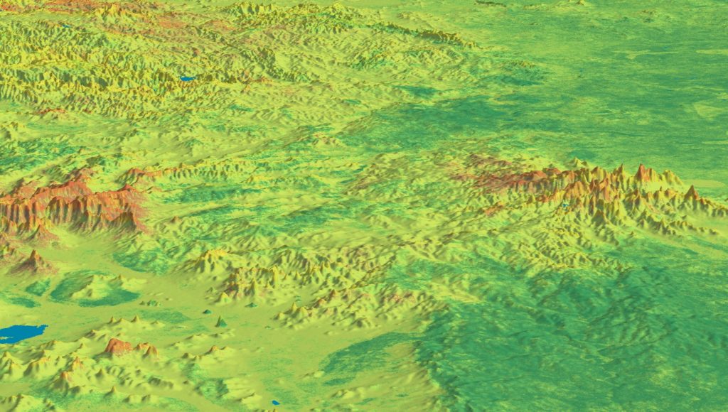
Image from the Soil and Landscape Grid of Australia of Total Nitrogen at soil surface 05cm average
Image from the Soil and Landscape Grid of Australia of Total Nitrogen at soil surface 05cm average
National and international impact
National: Recognised as essential national research infrastructure (through TERN); range of uses and users continues to grow and there has been a surge in the use of soil data in decision-making. For example:
- improved farm decision support (through Yield Prophet, SOILMAPP, SoilWaterApp)
- better and more immediate agricultural valuations and natural capital (through the Rural Intelligence Platform by DASco)
- soil moisture monitoring in ecological studies
- pipeline and railway corridor plans
- land development planning
- policy development in the NLP
- integration into the Land-Use Trade-Offs (LUTO) model as part of CSIRO’s Australian National Outlook initiative.
International: part of new global data sets produced by Food and Agriculture Organization (FAO) and United Nations Framework Convention on Climate Change (UNFCCC); methodology now used in soil health programs in the Pacific.
Useful for reporting on Sustainable Development Goals 2 (Zero Hunger) and 15 (Life on Land) in particular, and is relevant to many others. The Grid provides outputs relevant to the Paris agreement and especially the 4 per 1000 initiative, which intends to increase soil organic matter and carbon sequestration.
Why CSIRO?
Quality science, trusted networks: Before the Grid there was no credible, usable, national system for accessing soils data. In Australia, state and territory government agencies are primarily responsible for the collection and management of soils data, typically in data systems tailored to the requirements and regulations of the individual agencies.
CSIRO has long hosted the Australian Collaborative Land Evaluation Program to encourage national standards and consistency and to move towards national products. With the networks in place and the convening power of the TERN Soil/Landscape facility led by CSIRO, it was possible for CSIRO to drive and host a collaborative effort to provide the key data and use the established skills in data, analytics and soil science to create the Grid.
Partners
Terrestrial Ecosystem Research Network; University of Sydney; Geoscience Australia; state and territory governments (particularly agriculture, water and environment agencies); The Australian Collaborative Land Evaluation Program.