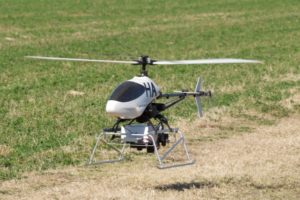
Phenocopter
This 2 year CSIRO internally funded project developed an integrated image capturing package and a common workflow that guides researchers to acquire and process ground level and low-altitude aerial images of vegetation and derive or predict key variables associated with biophysical and count statistics. The project was a collaborative effort between the former CSIRO ICT Centre and CSIRO’s former Plant Industry division The Autonomous Systems Program focused on the development of avionics including the sensor payload for an unmanned helicopter – the Phenocopter.
- low-altitude remote sensing for applications in agriculture
- first Phenocopter flight trial 2009 in Gatton
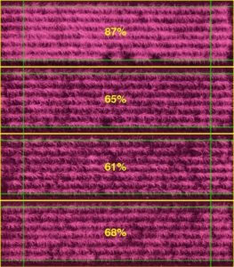
- sensor payload: high-res LWIR, RGB, NIR vibration isolated cameras
- cameras synchronously triggered by flight computer and images recorded on-board at full resolution
- mission planning and image analysis software optimised for applications in agriculture
- more information MDPI Paper
Drone scan of crops

Drone Thermal Scan
Drone
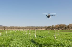
Drone scanning crops
Previous post:
Coming up next: