NovaSAR-1 images regions affected by Ex-Tropical Cyclone Alfred and flooding
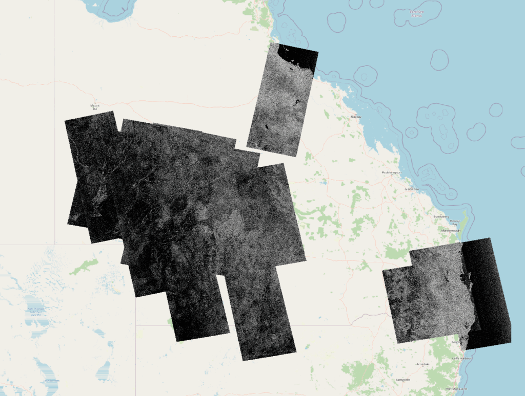
NovaSAR-1 images over flooded regions in 2025 overlaid on a map of Australia
CSIRO acquired a number of images to cover natural disasters in early 2025. We tasked images over the NSW and QLD coasts 10 – 12 March following ex-cyclone Alfred and several images over Townsville and southwestern QLD between 29 March and 16 April during flooding which followed unprecedented rainfall.
The images were up to 784 km long and used a ScanSAR mode with 195 km swath width, both HH and HV polarisations and 50 m pixel resolution. This mode was chosen to maximise the area covered. The images in this post show the CEOS-endorsed Normalised Radar Backscatter data derived from the raw SAR data.
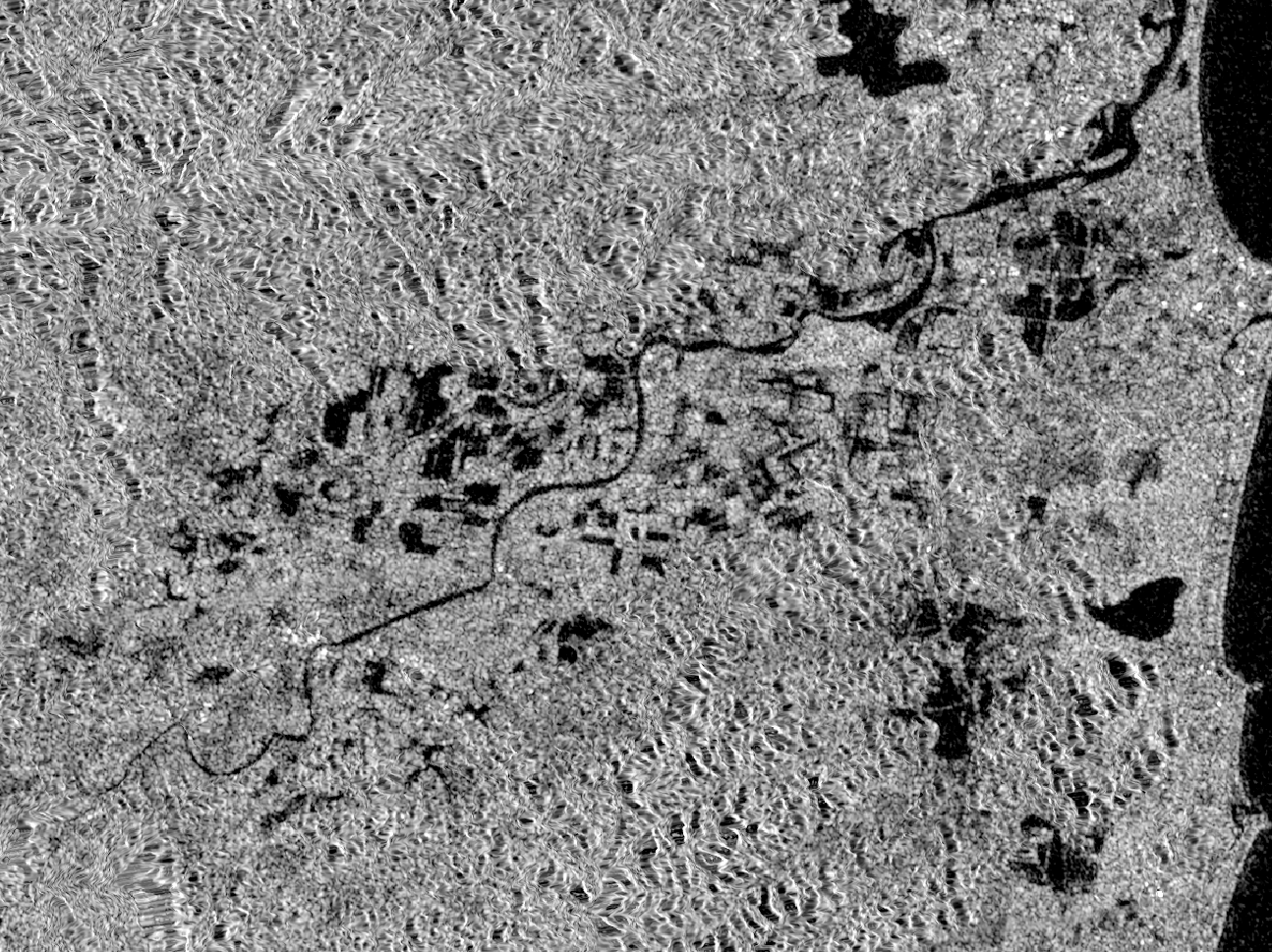
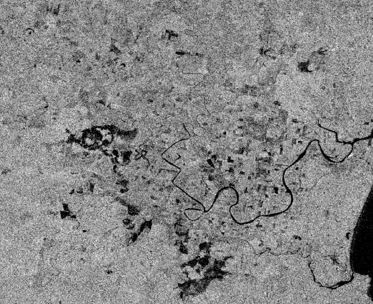
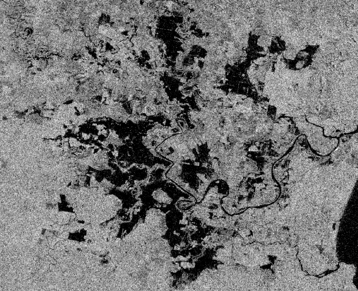
Flooding in New South Wales is readily evident in the NovaSAR-1 data. The HV image does a good job of highlighting areas of open water as low backscatter (dark in the image). In the HH image we also see this low backscatter over open water, but additionally there are areas of higher backscatter (bright in the image) which correspond to floods occurring under vegetated conditions. Undoubtedly, the long radar wavelength (~9.4 cm) employed by NovaSAR-1 is a factor in penetrating canopies to image double-bounce reflection off the water surface beneath.

All NovaSAR-1 images shown above and the rest of our archive, are available for free download from the CSIRO NovaSAR-1 National Facility Datahub (following registration).

Anyone can request new tasking of the NovaSAR-1 satellite over a specific area of interest
Check out our Australia wide coverage in the NovaSAR-1 National Mosaic