About
What is Earth observation?
[An animation image appears of clouds in a sky]
Narrator: Will it rain tomorrow?
[Image moves up until an animation of a wheat crop can be seen below the clouds]
How big will the wheat harvest be?
[Animation image shows cracks appearing through the ground growing the wheat]
How much damage did the earthquake cause?
[Animation image changes to show the world globe and the camera zooms out to show satellites orbiting the earth and their beams covering the earth and text appears beneath: Earth Observation]
We can answer questions like these with Earth Observation using sensors to learn about land, water and the atmosphere.
[Animation images move through to show a satellite attached to a buoy moving up and down in the ocean, a drone and a plane moving through the sky, and then a satellite circling the earth]
The sensors can be placed on the ground, attached to buoys, or flown on drones and aircraft but most often they’re carried on satellites.
[Camera zooms out to show four satellites encircling the earth]
Using satellites has many advantages. They can cover large regions even the whole earth.
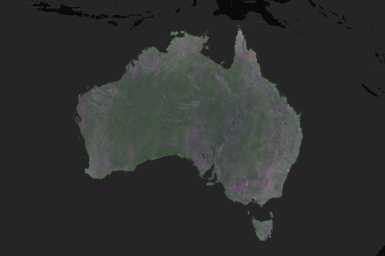
[Camera zooms in on the world globe and a weather system can be seen moving across Australia on the globe and bar graphs can be seen at the bottom of the screen]
Monitoring can be systematic and continuous. For instance, weather measurements are taken as often as every ten minutes.
[Camera zooms out to show the same image on a computer screen and two hands can be seen pointing to the information on the screen]
Satellite observations give us consistent objective data that could be shared by many users.
[Camera zooms in on Australia on the computer screen and circles appear around problem areas on the map and then three computer screens appear showing data at various spots on the map]
These data provide the information we need to make decisions and take action, to identify problems and protect the natural environment, to provide help after disasters, and to monitor our planet’s systems and predict changes.
[Animation image changes to show a computer screen displaying a chart showing various Electromagnetic radiation lines and text appears above the chart: Electromagnetic spectrum]
Most Earth Observation involves sensing some kind of electromagnetic radiation.
[Animation image changes to show the world globe covered with sunlight radiation lines]
Often this is ordinary sunlight.
[Animation image moves down and a satellite can be seen moving around the globe emitting radio waves towards the earth]
Sometimes it’s infra-red radiation. We can even use radar where the satellite sends out radio waves and receives their reflections.
[Animation image shows clouds appearing around the surface of the globe and the image shows the satellite continuing to travel]
The benefit of radar is that it can see through cloud and at night.
[Animation image zooms out to show four different satellites orbiting Earth and then dotted lines appear linking the satellites up to the CSIRO logo and the camera zooms in on the logo]
Hundreds of Earth observing satellites orbit the planet and they’re all giving us information we need to manage our world now and in the future.
[Music plays]
Satellites have the power to view and monitor the Earth as a whole, providing data to help us monitor the changing world around us.
About us
The CSIRO Centre for Earth Observation is part of CSIRO’s Space Program. We are CSIRO’s hub for national and international Earth observation activities. We support Earth observation research and applications by providing underpinning technologies and capabilities, maintaining key national and international partnerships, and working with expertise from across CSIRO and partner organisations to apply our Earth observation technologies to solve the grandest challenges.
The Centre for Earth Observation’s key priorities include:
- EASI – a cutting edge, scalable, cloud-based data analytics platform for large-scale Earth observation data applications
- satellite calibration and validation, including operating infrastructure and carrying out field campaigns
- managing Australia’s 10% capacity share of the NovaSAR-1 satellite as a facility for research
- developing capability in Earth observation research and applications, particularly using Synthetic Aperture Radar
- representing CSIRO and Australia in national and international consortiums such as the Committee on Earth Observation Satellites, Group on Earth Observations and the Asia Pacific Regional Space Agencies Forum
- working with more than 80 scientists from across CSIRO to implement our capabilities and coordinate communities of practice for hyperspectral and Synthetic Aperture Radar data users
- collaborating with CSIRO’s Space Program to deliver end-to-end Earth observation capabilities, from payload design to novel data applications.