Paper: PoseMap: Lifelong, Multi-Environment 3D LiDAR Localization
IROS 2018 paper: PoseMap: Lifelong, Multi-Environment 3D LiDAR Localization
Reliable long-term localization is key for robotic systems in dynamic environments.
In a paper submitted to IROS 2018, we propose a novel approach for long-term localization using 3D LiDARs, coined PoseMap.
In essence, we extract distinctive features from range measurements and bundle these into local views along with observation poses. The sensor’s trajectory is then estimated in a sliding window fashion by matching current and old features and minimizing the distances in-between.
The map representation facilitates finding a suitable set of old features, by selecting the closest local map(s) for matching. Similarly to a visibility analysis, this procedure provides a suitable set of features for localization but at a fraction of the computational cost.
PoseMap also allows for updates and extensions of the map at any time by replacing and adding local maps when necessary. The approach was evaluated using two platforms both equipped with a 3D LiDAR and an IMU, demonstrating localization at 8 Hz and robustness to changes in the environment such as moving vehicles and changing vegetation.
PoseMap was implemented on an autonomous vehicle allowing it to drive autonomously over a period of 18 months through a mix of industrial and unstructured off-road environments, covering more than 100kms without a single localization failure.

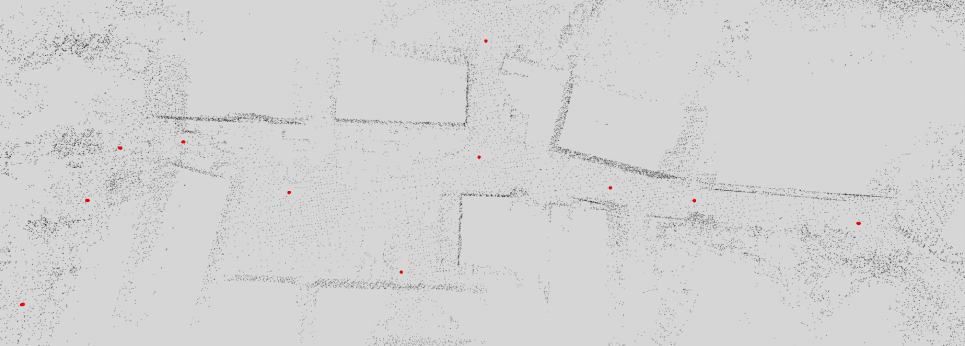
The image shows filtering with Toverlap = 0.8. Note that the entire open area is solely represented by 2 nodes. Along the way nodes are kept at intersections and other points of interest.
Click here to download the paper.
For more information, contact Dr Paulo Borges on paulo.borges [at] csiro.au
Philipp Egger, Paulo V. K. Borges, Gavin Catt, Andreas Pfrunder, Renaud Dubé, “PoseMap: Lifelong, Multi- Environment 3D LiDAR Localization”, in IEEE/RSJ International Conference on Intelligent Robots and Systems (IROS), Madrid, Spain, October, 2018.
