Geospatial Data Analysis
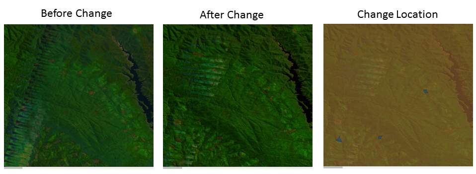
We aim to automatically detect forest cover change based on analysing large scale satellite imagery datasets. Our approach exploits recent success of computer vision algorithms on change detection and spatio-temporal feature learning.
Problem setting:
Satellite images provide a rich source of information for monitoring changes in forest vegetation, which is fundamental to assessing impacts of human activities and natural processes to the environment. With rapidly increasing volume of satellite imagery data, however, it becomes challenging to analyze and detect forest change in an efficient and timely manner. Current approaches rely heavily on manually designed features, focus on pre-defined change types, and only work on trend analysis at coarse temporal scale.
Our solution:
We propose to utilize advanced computer vision and machine learning algorithms to automatically detect forest change events and categorize the cover trends with high accuracy and efficiency. Our approach consists of three main components for satellite image analysis: i) Missing data estimation with Image/video inpainting. ii) Data-driven spatio-temporal feature learning iii) Weak supervision and domain adaptation of change detectors.
Collaboration:
- Joint project with Geoscience Australia to exploit the large-scale Lansat image dataset in the Datacube system.
- Working with the Department of Environment Australia to understand fine-scale forest change and provide analysis tool-chains.