ePaddocks™: mapping every paddock across the Australian grain region
ePaddocks™: hassle-free access to paddock boundary data for unlocking paddock-based applications and insights across the Australian land sector
What problem does ePaddocks™ solve?
Digital agriculture services can greatly assist growers monitor their paddocks and optimise their use throughout the growing season.
However, a prerequisite is to know the exact location of paddocks and their boundaries. Unlike property boundaries, which are recorded in local council or title records, paddock boundaries aren’t historically recorded anywhere. As a result, digital services currently ask their users to manually draw their paddocks, which is time-consuming and creates a disincentive.
The ePaddocks™ mission is to facilitate the development of paddock-level analytics across the Australian land sector by delivering high-quality paddock data across the grains region. Our method is scientifically validated and peer reviewed. At its core, our approach is based on artificial intelligence.That is, we teach computers to understand satellite images. Moreover, we teach our computers to perform multiple tasks at once because it has been shown to improve learning overall. Think of it as learning a new language, like Russian, which has its own alphabet. Learning to read and write at the same time is easier because you can associate a character with a sound and vice versa.
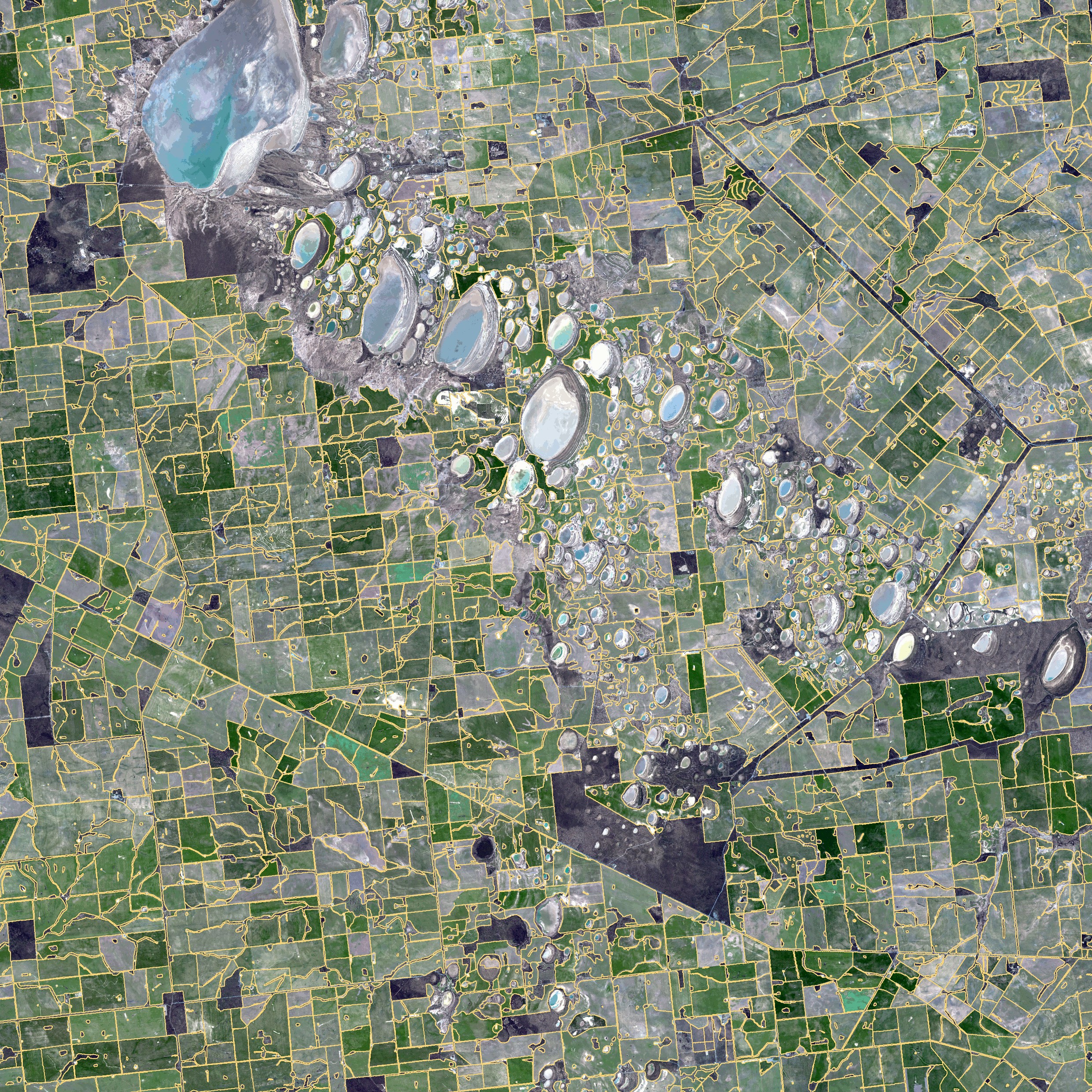
Satellite image overlaid by ePaddocks showing the paddock boundaries (in yellow) on 45 x 45 square kilometres of Western Australia. Credit: Copernicus Sentinel data 2019.
What can ePaddocks™ be used for?
- Paddock-level monitoring. A standalone geospatial product that service providers in the agricultural sector would use to on-board their farmer clients. ePaddocks™ eliminates the need for manual input, which is a major hurdle for new clients.
- Crop identification. A critical data input into continental earth observation and predictive analytics products and services. An immediate customer opportunity here is to utilise the paddock boundary layers as an input into the land-use classification system, and yield prediction services. This would enable consideration of object-based classification rather than pixel-based, which is a current difference in processes amongst competing commercial companies offering analogous products.
- Rural intelligence and portfolio analysis. The finance sector and providers of rural services requires this data product to disaggregate regional data to a farm or paddock scale. These initiatives include those seeking to understand their share of the market and how to manage logistics and product placement.
What about accuracy?
Our users need to know they can trust our paddock boundaries, and they need to integrate the product’s limitation into their applications. There are many aspects of paddock boundaries that require validation such as their extent, the location of their boundaries, their shape etc. Therefore, the accuracy of paddock boundaries is best communicated with a set of metrics. These metrics are derived by comparing actual paddock boundaries with the boundaries derived from satellite imagery.
We have chosen to characterise the accuracy of paddock boundaries with four metrics: the overall accuracy, the eccentricity factor, and the under segmentation and over segmentation rates.

Where can I get more information on ePaddocks™?
Read our media release or our blog.
Watch project leader Franz Waldner present on the science of ePaddocks™.
‘Detect, consolidate, delineate: scalable mapping of field boundaries using satellite images’ by Franz Waldner (9:19 minutes)
Read the recent publication:
Waldner F, Diakogiannis FI (2020) Deep learning on edge: extracting field boundaries from satellite images with a convolutional neural network. Remote Sensing of Environment 245, 111741. doi:10.1016/j.rse.2020.111741.
How can I access ePaddocks™?
ePaddocks™ is available as a free sample and for purchase on CSIRO’s AgData Shop.
To discuss how you might be able to incorporate ePaddocks™ into your digital agriculture product, submit our form or contact Dave Henry:

Dr Dave Henry
- Dave is a Principal Research Scientist, based in Melbourne, and is Research Leader of the digital agriculture initiative in CSIRO Agriculture & Food. Dave manages CSIRO's AgData Shop.