Model Description
Model Domain
The model domain needs to include 3 components – the entire harbour itself, the major rivers to the toes of their salt wedges, and that part of the Indian Ocean which can exert any significant influence. The first component extends westward from the harbour entrance to Birch’s Inlet and the Gordon River mouth. For the second component, there are 2 major rivers which feed into the harbour – the King and the Gordon. For the King River the salt wedge extends approximately 10km upstream, while for the Gordon it extends approximately 40 km upstream to a point below where the Franklin River joins. For the third component, the model domain needs to extend westwards into the Indian Ocean far enough such that the open boundary can be considered to be essentially unaffected by the waters exiting from the harbour i.e. to a point where boundary values of temperature and salinity can be assumed completely oceanic. Preliminary tests have shown this to be about 25km offshore from Cape Sorell.
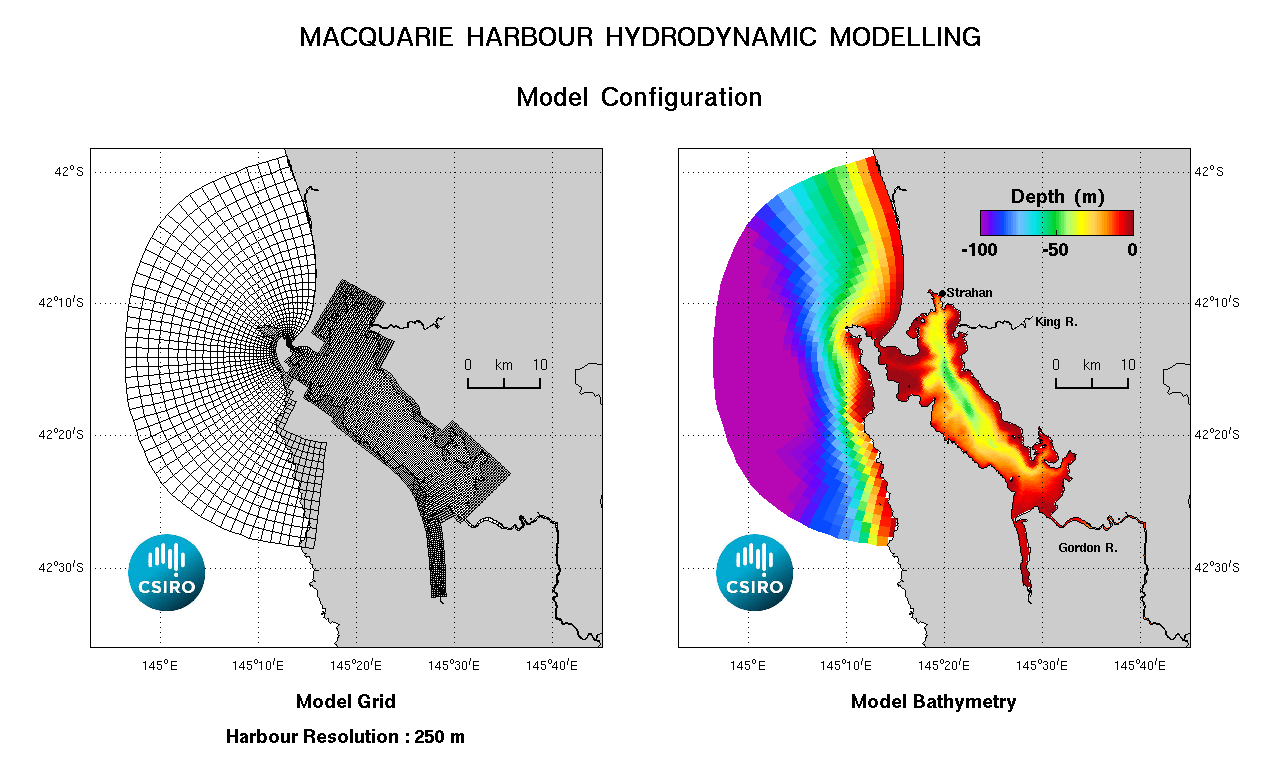
Model Configuration
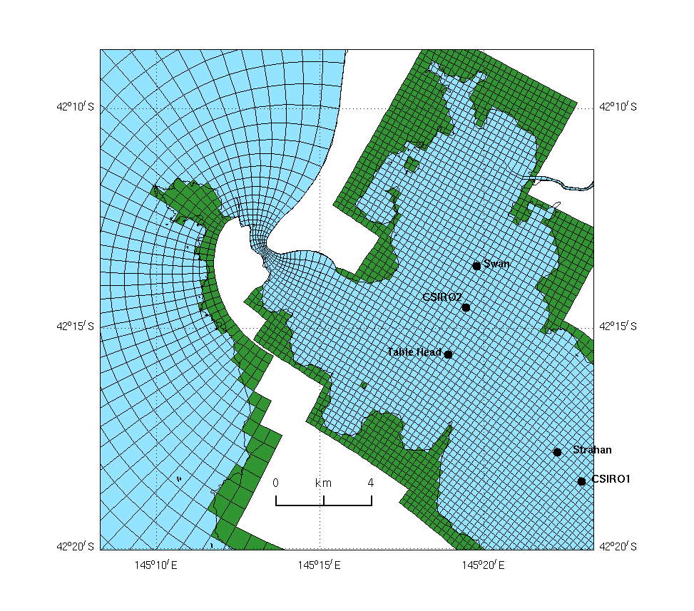
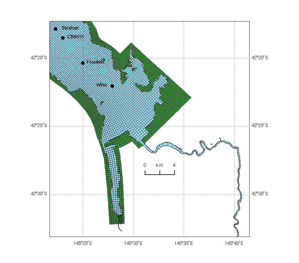
The final model grid contains 322 x 103 grid cells in the horizontal, with just a single row of cells each to define the Gordon and King Rivers. The resolution within the harbour is approximately 300m. It is less within the rivers, but increases to 2km at the offshore boundary. There are 22 layers in the vertical, with a 1m resolution near the surface. Plots of the model grid are also given for the harbour entrance, middle harbour and lower Gordon.
Bathymetry data for the harbour and ocean was digitised from RAN hydrographic chart AUS177. This chart does include however some unsurveyed areas and as well it excludes both the King and Gordon Rivers and Birch’s Inlet. Data for the latter should be available from Hydro Tasmania and possibly from the Fishing and Tourist industries which both run vessels around the harbour and along the Gordon River, but to date this has not been done. An estimate of depths along the Gordon River was obtained from a bathymetry plot derived in Tyler et al. (2001). Upon interpolation of the available depth data onto the model grid, a maximum bathymetry depth was set at 150m and a minimum at 2m to produce the final model bathymetry.
Model Forcing
Data required to force the model consists of meteorological data, oceanic sea-level, oceanic salinity and temperature, and river flow and river temperature (river salinity at the upstream boundaries being assumed zero).
Meteorological data (wind, atmospheric pressure, air temperature, dew point and cloud cover) is largely available from BoM for both Cape Sorell and Strahan Airport. This data could be assumed spatially uniform across the model domain, however for reasons of ease-of-use and reliability, it was decided to use BoM’s surface fields from their atmospheric model ACCESS. This data is available as hourly records in both near real-time and as a forecast, and has a spatial resolution of approximately 10km.
Sea-level data for the region, is only available from a tide gauge operated by Hydro Tasmania at the Strahan Wharf. Tides along the ocean open boundary can be determined from global model harmonics, however measured low frequency sea-level data is not available. This component can be inferred with a lead-time from the Strahan data since the low-frequencies are not attenuated by the narrow entrance channel as are the diurnal and semi-diurnal tides. Alternatively, it is available as an output variable from BoM’s OceanMAPS modelling product
Oceanic salinity and temperature, as a function of position and depth, are also available from OceanMAPS as daily records in both near real-time and as a forecast. This data also has a spatial resolution of approximately 10km in the region.
River flow and temperature is required at 2 river boundary points of the model. A previous study (Palmer et al, 2001) describes a hydrological model which was used to ascertain the flow of the Gordon, at a point below the Franklin confluence, based on rainfall and catchment size, thus taking into account flow from the intermediate rivers such as the Olga, Denison and Franklin. However, more recently, near real-time data has become available from Hydro Tasmania for both the King & Gordon Rivers. For the King River, flow and river temperature is available for the Quarter Mile Bridge site which is just upstream of the King model boundary. For the Gordon River, flow and temperature data is available for the Gordon-above-Denison site, while just flow data is available for the Gordon-above-Franklin site. For the purposes of forcing the model, the Quarter Mile data is used as is, while for the Gordon River, flow is used from the Gordon-above-Franklin site and temperature is used from the Gordon-above-Denison site. Note that no data is available at this atage for Gordon-below-Franklin & so flow from the Franklin is currently not accounted for in the model.